Recent months have been quite complicated. One side-effect is that I have found it hard to research and write.
Sometime in the next six or so weeks I will be moving. In preparation for this, I have been clearing out papers. One useful side effect is that I found some papers that I thought that I had lost.
The continuing attempts to gain self-government for New England or the North form one of the unifying elements in New England history.
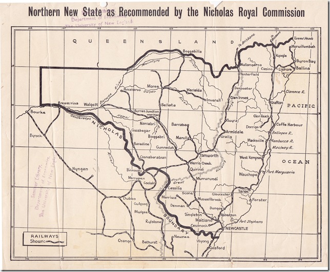
One vexed question has been the best boundaries for the proposed state. This has been a matter of constant debate on this blog and on the New England New State Movement Facebook page.
In the following map I found the boundaries as recommended by the Nicholas Commission and subsequently adopted by the new state movement. These are the boundaries on which the 1967 plebiscite was fought.
I thought that I should put them on line because it is actually very hard to find proper maps. 


