One of the issues that has to be addressed in any regional history is just what boundaries to use. It is easy when you are writing a history based around a defined political entity, so much harder when you are dealing with a less defined entity whose boundaries have shifted with time.
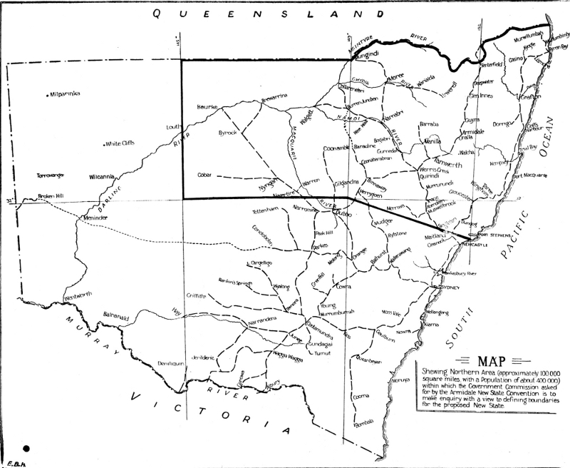
The following map shows the boundaries used by the 1924 Cohen New States Royal Commission. Comments follow the map. 
To begin with, this is the area on which the Cohen analysis was based. So analysis of the results of that Royal Commission has to take these boundaries into account. Then, too, the boundaries reflect opinion at the time.
Not that the boundaries bisect the Hunter Valley, leaving the Lower Hunter in NSW. This reflects perceptions that the lower Hunter would oppose self-government.
Now, as an historian, I have to include the Hunter in my history of New England. It just is. However, I have also to take into account changing perceptions of the boundaries and the way these have affected regional history.
It's an interesting challenge, especially when new state support is on the rise again, raising all the old issues.
Postscript
In a comments, Greg asked about the boundaries recommended by the Nicholas Commission. My proper map is in storage. However, the following graphic shows the back of a New England New State Movement envelope with the boundaries set out. The boundaries are mainly based on watersheds. The boundaries also encapsulate what has generally been known as the North, although New England new state support extended beyond these boundaries on the slopes and plains.


