Discussions on the history and historiography of Australia's New England

Thursday, December 27, 2012

History revisited - just a bit of bull

One of the little known facts about Armidale is its role as national headquarters of a remarkable number of beef breed societies. I haven’t counted them all, but there are over twenty. I didn’t know that there were that many beef breeds!

This fact got me wondering about the history of cattle in Australia.DrakenbergCattle3

I found that the first cattle to arrive in Australia came on the first fleet, picked up at the Cape of Good Hope on the way through. There was old Gorgon the bull, four or five cows and a calf. They were almost certainly of Africander breed, with probably at least one balck Vaderlander.

They quickly strayed after a convict who was meant to be watching them fell asleep. Livestock were valuable. Five hundred men were mobilized to search for the cattle, but to no avail. There were no more known cattle in the colony until another ship arrived three years later, again from the Cape, with eleven black Vaderlanders aboard.

In 1795, a convict was told by an Aborigine about a herd of cattle to the west of Sydney. He went to investigate, and found the escaped herd near modern Camden. It had grown to sixty one, a remarkable rate of increase for such a small herd in just seven years.

In the still small settlement, these cattle were a valuable resource. Governor Hunter rode to see them. He named the area Cowpastures, made it a reserve for the wild cattle and ordered a guard house built to stop poachers. Numbers grew steadily.

Sydney was full of rogues intent on enriching themselves. Governor King laid personal claim to a large number of the wild herd on the basis that Governor Phillip had owned part of the original herd and had given them to him. The wild cattle were difficult to catch. King therefore promptly swapped the claimed cattle for 200 tame Zebu and black cattle from the Government herd!

In a colony of rogues, John Macarthur was the rogue of rogues. On his first exile in England, Macarthur went to see Minister Camden and persuaded the minister to give him a very large land grant around Mount Taurus.

This was blatant chicanery. Lord Camden had no idea that Mount Taurus was in the centre of the cattle reserve, that he was giving Macarthur not just a land grant, but control of the wild herd itself. Governors might object, but the grant stuck.

Macarthur himself was more interested in sheep than cattle. His efforts here laid the base for another great New England industry.

Some of the best cattle were domesticated, others were shot for meat. The herd vanished. However, its rugged genes became widely spread throughout the colony’s rapidly growing cattle numbers.

Note to readers: This post appeared as a column in the Armidale Express Extra on 19 December 2012. I am repeating the columns here with a lag because the Express columns are not on line. You can see all the Belshaw World and History Revisited columns by clicking here for 2009, here for 2010, here for 2011, here for2012(Belshaw's World), 2012 (History Revisited).

Wednesday, December 19, 2012

History revisited - performing arts shows town's dramatic side

The first “big” play that I ever intended was an Armidale Theatre Club production in the old Parish Hall. I was very young and it was quite frightening!

Why? It was a murder mystery about a serial killer. He had a desk that included a secret drawer in which was to be found a noose. He used this to strangle women.

To get to the drawer, he had to carry out a special movement, a sort of a hand wriggle. Now there I was in the dark of the Parish Hall, watching an aunt standing with her back to the murderer while he got out the noose. See why it was frightening?

During the week, Judith Ross Smith sent me her book Never Whistle in the Dressing room: a history of the Armidale Playhouse 1953-2003 (Kardoorair Press 2005). From that book, I know that the play was probably The Ladykiller, one of the fist productions of the Armidale Theatre Club.

That actually makes me feel very old!

Armidale and the surrounding area has a quite remarkable theatre tradition. At the time my girls were born there, we had a choice of fifty different productions within one hour’s drive of our home. That’s astonishing.

Armidale shares part of its story with the broader New England, the way in which smaller communities created their own fun. But there were also special features in Armidale associated with its role as an education centre for the broader New England and well beyond.

Many of those features are entwined in my own mind, either directly or through my knowledge of our area’s shared history.

In December 1923, for example, the Sydney Morning Herald announced that The Armidale School Dramatic Society would present the Greek play, "Prometheus Vinctus of Aeschylus" in the original Greek; the Quarrel Scene from Corneille's "Le Cid;' and "Gaspard de Coligny," by W. Wentworth Shields (an old boy)at the King's Hall. You could buy tickets at Paling's.

To my knowledge, this is the first time that an Armidale theatre group presented a play by an Armidale author to a Sydney audience. That’s interesting, but it was the reference to the original Greek that caught my eye.

Digging into the story a little, I found that the senior boys in the TAS Greek class, TAS then taught ancient Greek as well as Latin, wanted to make TAS and Armidale the Australian centre for studies concerned with classical Greek!Hoskins Centre

There is something wonderfully eccentric about this notion, but then theatre in Armidale has always seemed a little larger than life.

Today Armidale has many production venues. The photo shows the inside of the Hoskins Centre. That wasn’t always the case.

Initially, plays were presented in one of Armidale’s little halls or in the Town Hall. The opening of the Teacher’s College added a new venue. Then in March 1969, the Armidale Theatre Club opened the Armidale Playhouse as Armidale’s first dedicated venue. But that’s a story for another column.

Note to readers: This post appeared as a column in the Armidale Express Extra on 12 December 2012. I am repeating the columns here with a lag because the Express columns are not on line. You can see all the Belshaw World and History Revisited columns by clicking here for 2009, here for 2010, here for 2011, here for 2012(Belshaw's World), 2012 (History Revisited).

Wednesday, December 12, 2012

History Revisited - Armidale's retail changes

One of the significant changes in the Armidale streetscape over the last sixty years has been the decline in the corner store. They are still there, but their numbers have diminished.20090515-11-12-58-around-armidale--streets-and-architecture

Even sixty years ago, many Armidale households did not have a car. Bus services did exist, but they were infrequent. Some products such as milk, bread or ice were delivered on regular rounds. By then, you could order groceries for home delivery by phone, although store staff still visited to take orders at the back door from regular customers. But for many, a walk to the nearest corner store was still the normal way to buy day to day items.

You can only carry so much in a string bag. For that reason, the stores were quite widely spread, with the greatest concentration in the old city south of the creek.

Then as today, kids had vivid memories of the nearest stores for there you bought lollies or snacks. .You may be surprised at just how often those memories feature at reunions, on Facebook pages or in email exchanges among the tens of thousands of people now living elsewhere whose memory of Armidale was formed in childhood and at school.

In our case, it was Mrs Beatty’s store, now Knights. Midway between our parents and grandparents houses, we visited often.

I remember being sent there with a note from my mother. In return, I received a brown paper package to bring home. It would be years before I worked out that the package contained a sanitary napkin!

The transformation that we would reshape Armidale shopping was already well underway.

While there is debate about the exact genesis of the concept, the idea of the supermarket first emerged in North America with the spread of the automobile.

The concept was a simple one. Instead of customers knowing what they wanted and then ordering from a shop assistant who packed items individually, replace this with a more open store where customers chose and then carried the item to the check-out. This allowed greater variety and was cheaper.

It took some time for the concept to reach Armidale.

In the period after the Second World War, three Armidale businesses (Hanna’s, Richardson’s and Burgess’s) progressively introduced the concept. As they did, the centre of retail gravity shifted.

Initially, the changes were locally driven. Then came the chains.

In Armidale, there were two of what were then called variety stores, Coles and Penneys. They were great for kids with limited budgets looking for cheap Christmas presents for family. They also had toys!

Coles transformed. Expanding rapidly, it bought Penneys among others.

In 1960, G J Coles opened its first Australian supermarket. I haven’t checked my facts here, but my recollection is that Coles first reached Armidale when they took over Richardson’s grocery business. A new era had begun.

Note to readers: This post appeared as a column in the Armidale Express Extra on 5 December 2012. The photo is by Gordon Smith. I am repeating the columns here with a lag because the Express columns are not on line. You can see all the Belshaw World and History Revisited columns by clicking here for 2009, here for 2010, here for 2011, here for 2012(Belshaw's World), 2012 (History Revisited).

Wednesday, December 05, 2012

History revisited - ship sales marked the end of an era

On 31 March 1954, the Sydney Morning Herald reported that the North Coast Steam Navigation Company had called for tenders for the sale of its nine ships. This announcement marked the end of a now largely forgotten era.

The Company had begun in 1857 as the Grafton Steam Navigation Company primarily to get the produce of the coast and tablelands more effectively to Sydney. Over time, it grew into a significant coastal shipping operation. Now squeezed by rising costs, the company had decided to go into voluntary liquidation.

Before the construction of the Great Northern Railway, people living in Armidale and surrounding districts had a choice in bringing goods in or sending produce out. You could send them overland to the river port at Morpeth on the Hunter or, alternatively, down one of the precipitous tracks over the escarpment to one of the North Coast river ports.

The choice was made on grounds of cost and convenience. From Armidale north, the focus was west-east to the coast. At Tenterfield just prior to the construction of the railway, several hundred people were employed carting goods between the Tablelands and the Northern River ports.

Even after the construction of the railway, the coastal trade continued. As late as the 1930s, some North Coast students at the Armidale Teachers College found it easier to go to Sydney by rail and then complete the journey by steamer because of the bad condition of the roads to the coast. One student remembered being lowered in a wicker ware basket from the steamer onto the long wooden pier at Woolgoolga that used to stretch from the beach into the open sea.

The Northern seas could be treacherous. Wrecks were common.

The 2005 ton twin screw steamer Wollongbar was the pride of the North Coast fleet. It had accommodation for 235 first-class passengers, 40 second-class and extensive general cargo.wollongbar-slnsw-a640348r

On 14 May 1921 the ship was alongside the jetty at Byron Bay when a storm broke out. Attempts to move the vessel into the Bay failed. It was driven ashore and wrecked. Its replacement, the Wollongbar II, was lost of Crescent Heads in 1943.

The Second World War came far closer to Armidale than many realise. Japanese submarines operated along the Northern coast, torpedoing ships and laying mines. The mini-sub attack in Sydney Harbour is well remembered because of the panic it caused. Fewer people remember the sea war of the New England coast.

During the War, both the Great Northern Railway and the New England highway were vital transport links. Troop trains and war supplies passed through the Armidale railway station on Brisbane bound trains.

The railway is gone now, of course. Armidale itself would have lost its rail connection without the work of our local activists.

The mournful sound of the whistle of the Brisbane Mail as it travelled through Armidale at 3am is a fading memory. The railway station at Wallangarra with its dual Queensland and NSW stations with their very different architectures stands as a mute memory of that past.

Note to readers: This post appeared as a column in the Armidale Express Extra on 28 November 2012. I am repeating the columns here with a lag because the Express columns are not on line. You can see all the Belshaw World and History Revisited columns by clicking here for 2009, here for 2010, here for 2011, here for 2012(Belshaw's World), 2012 (History Revisited).

Wednesday, November 21, 2012

History revisited - Armidale's landscape reveals its history

I thoroughly enjoyed presenting last week to the Armidale North Rotary Club.

My thanks to Mick Duncan for arranging the talk and to the Club for allowing non-Rotarians who had heard about the talk to attend. I really appreciated that.

I was asked why there were in fact so few Armidale blue brick homes. This is the quintessential Armidale building material, yet most of the older houses are weatherboard.20090515-11-08-00-around-armidale--streets-and-architecture

The present built landscape of Armidale reflects every stage in the city’s history.

If you look at an Armidale street map, you will see a central core of rectangular blocks separated by streets running north-south and east west. This is the old measured Armidale.

The 556 people who lived in Armidale in 1851 straggled. Alcohol flowed, horse races were held in the dusty main street, stringybark huts dotted the landscape. It was a rough and ready male dominated place.

Order was imposed on Armidale over the second half of the nineteenth century. In social terms, the male oriented frontier society was replaced by families who (and especially the women) demanded an ordered society. In spatial terms, the previous straggle was replaced by the neat grids we know today.

The physical landscape of Armidale is all about money.

Armidale’s population grew from 556 in 1851 to 4,249 at the 1901 census. This growth created wealth.

The Armidale mercantile and professional families often built in brick because they could afford too. The growing number of ordinary workers, the railway families and trades people, built smaller cottages in cheaper weatherboard. These cottages were built on the then outskirts of the city and especially in West Armidale towards the Railway Station.

The twentieth century political landscape of Armidale reflected these patterns. Armidale Town Hall voted Country Party, whereas West Armidale was Labor Party territory.

By the 1950s, the city’s growth had over-spilled the old boundaries. Newer houses were built in brick. Urban in-fill had started. Flats had begun to appear.

In all this, one of the most remarkable changes has been in colour. Armidale’s colours have changed.

Today, everybody remarks about the heritage colours, about the city’s greenery. I love them. They are simply wonderful. Few realise how recent they are.

Flying into Armidale in the 1950s or 1960s, three colours dominated; white, red and green. White because the predominantly weatherboard houses were generally painted white. Red and green because they were the standard galvanized iron roof colours.

Armidale always had parks and trees. But many of the trees we so love date from the Armidale Beautification Committee campaigns that began in the 1950s.

And the heritage colours? They are due to new paint types that simply weren’t available before.

Note to readers: This post appeared as a column in the Armidale Express Extra on 14 November 2012. The photo is by Gordon Smith. I am repeating the columns here with a lag because the Express columns are not on line. You can see all the Belshaw World and History Revisited columns by clicking here for 2009, here for 2010, here for 2011, here for 2012 (Belshaw's World), 2012 (History Revisited).

Wednesday, November 14, 2012

History revisited - wine industry's vintage

There is a story, perhaps apocryphal, about a lecturer from the New England University College who went into a pub in Uralla and ordered a bottle of wine to go with dinner. After some scratching around, one was finally found. “Would you like a glass”, the waitress asked?

I mention this now because of Armidale’s recent focus on food and wine, including the forthcoming Under the Elms event at UNE. Many of we expats wish we could be there!

Even fifty years earlier, the Uralla pub story would have made no sense, for the Tablelands still grew and sold its own wine. By the time of the story, that had gone. I thought, therefore, that I should share with you the story of the rise and fall of the Tablelands’ wine industry.

In 1830, George and Margaret Wyndham purchased "Annandale" in the Hunter Valley, renaming the property "Dalwood" and building Dalwood House as a home.

In 1828 George had planted his first grapes using 600 cuttings purchased from James Busby. Following the purchase he immediately made the first commercial planting of shiraz at "Dalwood".

Produced in 1831, the first "Dalwood" vintage was not a great success; the "extremely hot conditions promised to make good vinegar." Still, in that same year Wyndham brought the 100,000 acre property "Bukkulla" near Inverell on the edge of the Northern Tablelands. There established another vineyard. Wine growing now expanded rapidly. By 1860, Wyndham's total holdings including “Bukkulla” were producing 11,000 gallons of wine per annum.

George Wyndham was not the only wine producer. Other settlers also planted vineyards and made their own wine.

The wealthier settlers were used to drinking wine, so it made sense to plant their own grapes. The surplus could also be sold locally through the little local hotels that dotted the stage coach routes.

As late as 1905, wine production from the Inverell area of New England was 227,000 litres from seven or eight larger vineyards and a number of smaller vineyards. Nor was this wine bad.

Between 1870 and 1920, wines from the area won many awards at wine shows in Sydney, Amsterdam, London, San Francisco, Chicago and France. A prominent English wine judge of the time wrote of the “Bukkulla” wines, “(They) have a character and quality above the average of most wine-producing countries. The lowest quality is better than a large proportion of the ordinary wines of Europe, while the best would not suffer in comparison to the finest known growths”.

And then all this vanished. Why? Part of the answer lies in that dreaded word, beer.

Initially, colonial New Englanders were not big beer drinkers. Among those wanting to imbibe to excess, to get smashed we would now say, brandy was the tipple of choice. The Australian colonies were one of the biggest global markets for French brandy!

Beer did not become readily available until improved brewing techniques allowed consisent quality. Beer did not become readily available until improved transport allowed bulk shipments. The combination made beer the drink of choice among ordinary Australians.

This was not the only factor.

The rise of the temperance movements, the wowsers, also changed things.

Wine drinking diminished; brandy retreated to the medicine cabinet where it became hospital brandy. Only beer survived. The Tableland’s wine industry was one victim of all this social and structural change. Now it is back!

Note to readers: This post appeared as a column in the Armidale Express Extra on 7 November 2012. I am repeating the columns here with a lag because the Express columns are not on line. You can see all the Belshaw World and History Revisited columns by clicking here for 2009, here for 2010, here for 2011, here for 2012 (Belshaw's World), 2012 (History Revisited).

Wednesday, November 07, 2012

History revisited - literature's window to our past

One of the big challenges faced by any historian is to break through the veil created by the present to that far country of the past.

The present determines the questions we ask of the evidence, but it does more than that. It creates an almost irresistible temptation to force the past to fit the past to present ways of interpretation. Yet the past is always with us, influencing us in sometimes unseen ways.

I referred to this in my last column when I suggested that Armidale’s history with its key interlocking threads of grazing and especially wool, government, education and politics influenced current life in ways not seen by those now living in the city.

As it happens, on Monday 5 November I am coming back to Armidale to talk to the Armidale North Rotary Club. My topic is Northern Images: landscape and literature through Northern eyes. In the promo for my talk, I said that would use a mixture of paintings, photos, film, poetry, literature and political symbols to give Club members a small taste of the changing ways in which those living in Northern NSW, the broader new state New England, have seen their world.

Last week saw the annual Maurice Kelly lecture at UNE.

Maurice, a tall, quiet and gentle man always interested in other people, founded (among other things) the Classics Museum at UNE. The annual lecture celebrates that event.

Wife Gwen who died recently was far more peppery. She was also one of Australia’s better known writers whose book The Middle-Aged Maidens,. a satirical study of life in a private girls' school created a real storm in the Armidale dovecots.

Like many writers, Gwen wrote in multiple forms and mined her own life for material.

I still remember the story that appeared in a women’s magazine about her daughter’s blond haired, blue eyed boyfriend Henry. Now the Henry in question was a particular mate of mine, and I think that she captured him to a T. “Hold this Mrs Kelly, and you will get an electric shock.” Hold it she did, and indeed she got an electric shock!

Both Maurice and Gwen were bought to Armidale through UNE, the education stream in Armidale history. Here Gwen joined a number of people connected in some way to UNE who wrote in one way or another about their Armidale experience.

Crime writer Robert Barnard began his writing career based on his experience as a lecturer in the English Department at UNE.

His first novel, Death of an Old Goat, was set in part in Dummondale University, and included the Drummondale School Head.

One later reviewer, put it:

As Police Inspector Royle (who had never actually had to solve a crime before) probes the possible motives of the motley crew of academics who drink their way through the dreary days at Drummondale and as he investigates the bizarre behaviour of some worthy locals, a hilarious, highly satirical portrait of life down under emerges.

The book is actually quite cruel. One of the funniest scenes is a group of local graziers sprung by the police doing a secret Aboriginal inspired rain dance to try to break the drought!

I have run out of space for this column. I guess that I will have to give you more in a later column on writers, painters, film makers and musicians and the way they saw Armidale and the broader New England.

Note to readers: This post appeared as a column in the Armidale Express Extra on 31 October 2012. I am repeating the columns here with a lag because the Express columns are not on line. You can see all the Belshaw World and History Revisited columns by clicking here for 2009, here for 2010, here for 2011, here for 2012 (Belshaw's World), 2012 (History Revisited).

Wednesday, October 31, 2012

History revisited - city founders' grand designs

Armidale’s built environment reflects the different stages in the city’s history. Those stages may now largely invisible in daily life, for the city changed enormously over the second half of the twentieth century, yet their effects linger.

One of Armidale’s most attractive and distinctive features is what I call the old city, that compact part of the city that stretches especially south from Beardy Street up South Hill. This is Victorian Armidale, with its blue brick and iron lacework.

Armidale residents generally take the old city for granted, it just is. Visitors to Armidale are surprised by it, as they are by the schools, for there is nothing quite like it elsewhere in Australia.

That surprise is itself a sign of the social and economic changes that took place in the North and throughout Australia over the second half of the twentieth century. Even fifty years ago, Armidale was widely recognized in Australia and beyond as the Athens of the North, the prospective capital in waiting of our own Northern state.

Four interconnected things built Armidale: grazing and especially wool, government, education and politics.

Wool was important because it was a high value product that supported European settlement beyond the immediate boundaries of settlement, the nineteen counties. Settlement exploded. To manage this, the Government in Sydney appointed Crown Land Commissioners to establish authority beyond the official frontier. One of these, George Macdonald, established his headquarters on the Tablelands and called the place Armidale.

As an aside, in checking a fact for this story, I found no less than four spellings of the Commissioner’s name, all in common usage!

The Commissioner’s action made Armidale an administrative centre. At the 1851 census, Armidale with a population of 556 was the largest Northern town outside the lower Hunter, followed by Port Macquarie on 519 and then Grafton on 319. Grafton would soon outstrip Armidale in population. But ten years later, Armidale was still the largest inland urban centre.

Armidale’s role as a centre of Government brought schools and churches. Both added to the still small town’s importance. Armidale, the city of schools and churches, was born.

Politics was important because it added to the process.

In 1920 the first full New State manifesto, Australia Subdivided, put a key problem facing the North in this way: In Northern New South Wales, a few high schools, no technical schools, no universities exist to retain the intelligence and culture of the area.”

The political battles that followed saw first a teachers college and then a university college established to meet the needs of the North. These new institutions drew staff and students to the city, adding to the mix. Armidale as we know it now was born.

The world changes and the city has changed with it. Yet the four interconnected themes of wool, government, education and politic still influence the culture and character of the city today. We don’t always see it, but it’s there.

In coming columns, I will explore some of those influences, showing how past and present entwine in a fascinating mix.

Note to readers: This post appeared as a column in the Armidale Express Extra on 24 October 2012. I am repeating the columns here with a lag because the Express columns are not on line. You can see all the Belshaw World and History Revisited columns by clicking here for 2009, here for 2010, here for 2011, here for 2012 (Belshaw's World), 2012 (History Revisited).

Wednesday, October 24, 2012

History revisited - a pressing change

A week back, The Armidale Express Facebook page carried a staff photo from the paper’s earlier days. That caused me to cast my mind back to the paper’s earlier days.

Express staff

On Friday 12 April 1929, the Sydney Morning Herald reported the formation of a new company, the Armidale Newspaper Company Limited, to purchase two Armidale newspapers, the Armidale Express carried on by P. C. G. Hipgrave and J. B. McKenzie and the Armidale Chronicle carried on by A. Purkiss.

This announcement marked another stage in a change process transforming the Northern press.

At the start of the twentieth century, even small towns had their own independent newspaper to press the interests of town and district. Many had several. Then the development of new and costlier technology with growing competition from the metropolitan dailies began to threaten the financial survival of the country press. Papers started to close or merge, while a number became dailies.

The new country dailies were aggressive. In the North, the Grafton Daily Examiner and Northern Daily Leader combined with the Lismore Northern Star and the Murwillumbah Tweed Daily to form the Associated Northern Dailies to compete for city advertising. In 1931 the Maitland Daily Mercury would join the group.

Competition from the Northern Dailies increased the pressure on the other newspapers still being published on a tri-, bi- or weekly basis. In the New England, the combination of train and truck allowed the Northern Daily Leader to reach towns from Tamworth to the border in time for breakfast.

Mind you, the competition was not all one-sided.

Following a bad train crash, Northern Newspaper’s Ernest Sommerlad wrote with glee to fellow director David Drummond in September 1926 that the Glen Innes Examiner had “got a good one on Tamworth yesterday, in connection with the rail smash.” “Armidale passed the word on that Tamworth were sending a special edition up, to arrive about 7pm”, Sommerlad explained. “I got busy & made a fine display of stuff in the short time available. Then hired a motor-bike and sent 350 copies to Inverell, having rung Knapton to get a dodger out in the meantime. The street was blocked with people waiting for copies & we made a great sale - & a great scoop.”

Despite such successes, the pressure on the smaller papers grew. Then in 1928, a financial adventurer, William John Beckett decide to launch a chain of newspapers around Australia. Armidale was mentioned as one of the key centres in the Beckett proposals.

Realising 'that at all costs Beckett must be prevented from getting a foothold in the North', Sommerlad agreed with Albert Joseph (the founder of the Northern Daily Leader) that the Tamworth Newspaper Company and Northern Newspapers should jointly sponsor the merger of the two papers. In Sommerlad's view, this intervention was necessary 'since the two Armidale proprietors were so mutually jealous there was no possibility of the amalgamation being brought about except by an outsider.' This view was supported by Drummond, now member for Armidale.

Tensions between the parties led the Tamworth Newspaper Company Board to refuse to participate. Northern decided to continue.

On 10 April 1929, The Armidale Newspaper Company Limited was formed with Dr. R.B. Austin (Chairman), E.C. Sommerlad (Managing Director) and Colonel H.F. White as initial directors. W.S. Forsyth, the main Armidale promoter, wrote happily to Sommerlad that he was 'pleased with the entire outlook.'

Drummond and three others were appointed to the Board at the first directors' meeting, and then, on 2 September 1929, the first edition of the merged paper appeared. The twentieth century Express had been born.

Note to readers: This post appeared as a column in the Armidale Express Extra on 17 October 2012. I am repeating the columns here with a lag because the Express columns are not on line. You can see all the Belshaw World and History Revisited columns by clicking here for 2009, here for 2010, here for 2011, here for 2012 (Belshaw's World), 2012 (History Revisited).

Wednesday, October 17, 2012

History Revisited - flypaper and chip heaters

Each period of New England life has had its own rhythms. Last week, I told a story from New England’s Aboriginal past, the week before I mentioned Masyln Williams’ evocative picture of Tablelands’ life during the 1920s.

Reading Williams reminded me of two things from my own past, things that older Armidale residents will remember that have now largely vanished.

Armidale has always had a problem with flies, both the blowfly and the common housefly. Hiking though the paddocks with the 2ndArmidale scouts (I still don’t know what happened to 1st Armidale!), the blowflies used to gather, attracted by the salt in the sweat that soaked our shirts under the packs we carried. Looking forward while walking in file, each scout carried his own crowd of flies hovering around the pack, diving to settle on the sweaty patches exposed as the pack moved.

As an aside, I had assumed that the blowfly was an Australian pest. Apparently not. It appears that the sheep blowfly arrived in Australia from South Africa in the mid to late 1800s, causing a major outbreak of fly strike in many areas in 1897.

The fly position in town was worse. Very few houses then had fly screens, doors and windows were always open in summer, allowing flies to congregate inside. What to do? Well, flypaper was one answer. This was a longish thin strip of paper coated with a sticky substance, sometimes impregnated with poison such as arsenic. This impregnation featured in two famous British murder trials where the accused was alleged to have soaked the fly paper in water to extract the arsenic for later nefarious use.

Hung from the ceiling or from an often begrimed dangling light shade, the flypaper was hardly an attractive sight. For that reason among others, it went out of fashion, despite its sometimes effectiveness in attracting and killing flies.

The second vanished item was far more attractive.

Many Australian places and especially in the country, had no access to gas or electricity. Water for bathing had to be heated on the stove and then carried to the bath or tub. This world was captured in a nostalgic poem by Mary Gilmore, The Saturday Tub. There, standing in a line by the fire, the children take their turn

To stand in tub the size of a churn,
It was, 'where's the flannel?" and, "Mind the soap!"
Slither and slide, and scuffle and grope

Despite Mary Gilmore’s childhood nostalgia, the process was very time consuming. An Australian invention from around the 1880s came to the rescue, one that took advantage of the relative availability of wood. This was the chip heater.

The cylindrical heater included a fire box that was fed with paper, pine cones and chips from the woodheap. Water circulated through the firebox, providing a supply of hot water for bath or shower.

Many older Australians have nostalgic memories of the chip heater drawn from child hood. We had one for a brief period when I was young, and there was an immense thrill in being allowed to light it and then feed the fire! They could be cranky and noisy, but they were also fun.

By the 1960s, the spread of electricity as well as water heated from slow combustion stoves had destroyed the market. The chip heater went the way of fly paper, leaving just memories behind.

Note to readers: This post appeared as a column in the Armidale Express Extra on 10 October 2012. I am repeating the columns here with a lag because the Express columns are not on line. You can see all the Belshaw World and History Revisited columns by clicking here for 2009, here for 2010, here for 2011, here for 2012 (Belshaw's World), 2012 (History Revisited).

Wednesday, October 10, 2012

History Revisited - Red Kangaroo & the Bundarra mob: an epic tale of warfare in prehistoric New England

The year is about 1720. The place a major bush camp outside what is now Gunnedah. The smoke from the camp fires drifts into the dusk air. Overhead, the stars are beginning to appear. The visiting envoys sit silent, waiting patiently. The warriors have been in council all day, and it is time for decision.

The trouble had begun some months earlier. The powerful Tablelands’ mob from the Bundarra-Kingston area had been raiding for women in Gamilaraay (Kamilaroi) speaking lands. They left the strong Nammoy River mob alone, but had struck at the Goonoo Goonoo and Maneela (Manila) River mobs with considerable success, seizing women and killing the warriors who had opposed them. Finally, both groups sent envoys seeking help from the Nammoy to get their young women back. The Nammoy could keep the Bundarra women taken, although if many were taken, perhaps the Nammoy would share.

Lit by the fires, Gambu Ganuuru (Red Kangaroo in Gamilaraay), the Nammoy warrior chief, moved to the centre of the gathering.

The Red Kangaroo was then about forty and had been war chief since the age of nineteen. At over 190cm, he was a tall well built man whose body carried the scars of past battles. Now he summed up. The prize of the Bundarra women was not of great concern, but it was “another thing to have this Bundarra tribe come raiding so close to our territory. We are strong now, and we have to break any strong tribe who is a danger to us. Do you agree with me that we fight the Bundarra warriors to prove whose tribe is the ruling tribe, first and last?”

There were ninety warriors in the war party that now assembled. The Red Kangaroo led the forty strong Nammoy party, while Goonoo Goonoo war chief Ilparra commanded the fifty warriors from Goonoo Goonoo and Maneela, with Maneela war chief Mooti second in command.

There was no chance of a surprise attack, for throughout the one hundred kilometre journey small Bundarra parties gathered on all sides, spying on them and driving away the game they needed for food. Finally, a bigger force than theirs came to give battle on a long granite sand-flat through which ran a wide stony creek.

Ilparra was killed early by a spear through the throat, with Mooti taking command of the combined Goonoo Goonoo/Maneela force. For two hours, neither the combined force nor the Bundarra warriors that opposed them could gain ground. Realising that the Nammoy warriors were getting too far ahead and out of touch with Mooti’s party, the Red Kangaroo ordered his men to turn to take the party fighting Mooti on its flank.

The main Bundarra party that had been fighting the Red Kangaroo called out three times. At this pre-arranged signal, those opposing Mooti ran back to the main Bundarra group. Mooti and his warriors pursued, ignoring Red Kangaroo’s calls for them to join him. In the following fighting, Mooti was killed and his warriors broken into small groups.

The position was now desperate. Red Kangaroo’s party were outnumbered, had thrown nearly all their spears, while the Tablelands’ spears would not fit into the Kamilaroi spear throwers. “Gather and break their spears”, the Red Kangaroo told his party. “We must make it across to that pine scrub where they will be forced to fight hand to hand.”

Using his powerful voice, the Red Kangaroo coordinated the fight against the still larger but more disorganised Bundarra forces. Fighting as individuals or in small groups, the Bundarra warriors finally broke and ran. Kibbi, their great war chief, was killed by the Red Kangaroo’s spear.

Red Kangaroo and his warriors came the main Bundarra camp. Only old men and women were there. “Go tell your warriors to bring their women and children back to this camp”, the Red Kangaroo said. “No warrior who comes back will be harmed.”

Under the peace terms now imposed, the stolen women were returned, while five women each were given to the Goonoo Goonoo and Maneela tribes. Thirty four young women and five young boys and girls were taken by the Red Kangaroo and his warriors for the Nammoy tribe.

I hope that you have enjoyed this tale from New England’s more distant past. If you would like to learn more, Ion Idriess’ Red Chiefgives a gripping fictional account, while Michael O’Rouke’s Sung for Generations provides a detailed analysis of the source material for all the Red Kangaroo stories.

Note to readers: This post appeared as a column in the Armidale Express Extra on 3 October 2012. I am repeating the columns here with a lag because the Express columns are not on line. You can see all the Belshaw World and History Revisited columns by clicking here for 2009, here for 2010, here for 2011, here for 2012 (Belshaw's World), 2012 (History Revisited).

Wednesday, October 03, 2012

History Revisited - sharing a love of history

Last year I came back to Armidale to deliver a paper on social change in the broader New England over the second half of the twentieth century. While in town I did as I always do, I went book shopping.

As a writer and commentator on New England history and issues, I need access to books and records, many now out of print and hard to find. For that reason, I buy what I can when I can. I also buy for the sheer joy of it, for we have had some wonderful writers.

On this trip, I struck real gold in the form of Maslyn William's His Mother's Country (Melbourne University Press, Carlton, 1988). I knew of Williams as an award winning Australian writer and documentary film maker, but had no idea of his New England connection.

Williams was born in England in 1911. After his parents’ death, an uncle sent him out to Australia to work as a jackaroo on a large station near Tenterfield. There he fell in love with Australia. His Mother’s Country explains why. Written in the third person (he calls himself the lad throughout), the book describes Williams’ experiences in 1920s New England, the lives and personalities of numerous individuals he encountered, and the distinctive identity of the landscape that ultimately claimed his loyalty.

It really is a wonderful book. It justly won the FAW Christina Stead Award in 1988 and then in the following year the Douglas Stewart Prize in the State literary awards.

Maslyn is not the only writer who describes childhood or early life in New England. Another is Judith Wright, a third Judith Wallace. Their writing traces the texture of a changing world in Armidale and beyond.

Last weekend, I was back in Armidale for a reunion of the TAS Leaving Certificate class of 1962. Those attending had come from all across Australia, from Hong Kong, Canada and the United States.

Scots Band 2012 As I waited to go to TAS, the sound of bagpipe music from nearby Central Park drifted across the motel balcony where I was sitting. Distracted, I packed away my notes and walked to the park to listen. It was PLC’s 125th anniversary celebrations, and the Scots College band was playing. I met the Headmistress and explained that my brother and I used to line up with the girls for our bread and jam, This was in the old school before the move to the top of the hill.

Later at TAS, we yarned about our shared history, about the changes that had taken place, about the things that we had done. For most of us, to come from Armidale or to come here for school or university is to leave the place. I have been lucky, for I have been able to come back on visits, then to live here again, and now once more to visit. For all of us, the links remain.

In coming columns, I would like to share with you some of those links through the wonderful history that we have in common: from spies to classical Greek plays; from the very local to the regional and beyond; from fly paper to chip heaters; from food to furniture; from our ancient Pleistocene past to the present.

I hope that you will come with me on the journey. I hope, too, that you will contribute your own stories.

Next week, I will give you a story of warfare beyond the frontier of written history, of a time before Captain Cook. It’s an exciting tale that I think that you will enjoy.

Note to readers: This post appeared as a column in the Armidale Express Extra on 26 September 2012 in the new History Revisited series. It was my first column after a gap. I am repeating the columns here with a lag because the Express columns are not on line. You can see all the Belshaw World and History Revisited columns by clicking here for 2009, here for 2010, here for 2011, here for 2012 (Belshaw's World), 2012 (History Revisited).

Sunday, September 30, 2012

Train Reading - Gammage, the Aborigines & the environment

My present train reading has been Bill Gammage's The Biggest Estate on Earth: How Aborigines made Australia (Allen & Unwin, Crows Nest 2012). I have written two posts on the book on my personal blog (Train Reading - introducing Gammage's The Biggest Estate on Earth and Train Reading - environment, mental maps & Bill Gammage). In this post, I want to look at Bill's arguments in more detail.

The book centres on the way the Australian Aborigines managed the country. Its thesis is that the Aborigines actively managed country to the point that they modified it to suit their needs. The landscape that the European settlers found in 1788 was consequently not a natural but man made landscape.

The Europeans then affected the landscape in two ways, one recognised, the other not. Their stock and overall land management practices affected vegetation, soil and water flows: trees were cleared; soils became compacted; run-off increased, with significant erosion. These effects have been well documented, although I think that Bill would argue that some have been misinterpreted.

The less recognised impact lay in the withdrawal of previous Aboriginal land management practices. This resulted in re-vegetation in some areas, along with hotter bush fires that affected plants and animals alike. Animals that had been common in some areas vanished, other animals saw an explosion in numbers. The combination of direct European modification with withdrawal of Aboriginal land management affected every aspect of the Australian environment, including its very physical appearance.

The explosive element in the book lies in the way it attacks two deeply held popular beliefs. One is the belief that the Aborigines lived in harmony with the environment, moving lightly across the land without affecting it. They may have lived in harmony with the environment, but it was their environment, one that they had made. The second is the idea that in conserving the environment, in creating things such as national parks, we are somehow returning the land to its natural state. If Bill is right, we are not. We are, in fact, engaged in another form of environmental modification. You see why I say that the book has an explosive element?

The book also challenges previous scientific analysis that attempts to explain changes in vegetation patterns just in terms of changes in things such as soils and climates. Further, it does so by use of historical evidence. Conflicts here led Bill to devote an entire appendix to defence of his position in the face of scientific skepticism.

To set the scene for the analysis that follows, this dramatic painting by William Strutt shows the Black Thursday bushfires of 1851. Those fires burnt approximately 5 million hectares, or a quarter of Victoria; 12 lives were lost, along with one million sheep and thousands of cattle. Pause and think about the effects of such fires on the Aborigines had they occurred with modern fire frequency. They didn't, and that provides my entry point.


There is plenty of evidence to show that the Aborigines burnt the country. Early European records often refer to fires lit by the natives, including the use of fire to provide later green pick that would attract grazing animals such as kangaroos that could then be hunted. Clearly, those fires would have had some effect on the environment. Among other things, they would have kept fuel down, thus avoiding catastrophic fires of the Black Thursday type. Fires of that intensity would have wiped out entire Aboriginal communities either directly or through loss of food supplies. The Aborigines weren't dumb. They lived in and knew their country. They knew the risk of fire. However, Bill goes a lot further than this in his argument, for he argues that the Aborigines used fire to consciously modify and maintain country to suit their needs.

The evidence that he provides begins with the descriptions of the countryside as seen by the first Europeans. They saw a patterned landscape, one that puzzled them because they couldn't understand how the varying vegetation mix might arise. Somehow, it seemed random. They also saw a landscape that reminded them of parks at home, of noble estates. Here Bill does us a service because he attempts to attach meanings to words that held at the time, not as we would interpret them today. A park was a stretch of open ground bounded by trees that might contain trees, but where the undergrowth was clear. The word did not necessarily have either the highly manicured or, alternatively, wild connotations that might apply today.

Bill then goes on to argue that this pattern was a human creation. To support this, he looks at the pattern of Aboriginal life. In looking at Bill's arguments here, I want to put aside arguments relating to the Aborigines' emotional, cultural and spiritual connections with the land. Instead, I want to focus on the way they lived.


This somewhat stylised painting by the convict artist Joseph Lycett (and here) is entitled "Aborigines using fire to hunt kangaroos".

Now I want you to notice a few features in the painting. Notice the park like nature of the open country. Notice the sharp dividing line between trees and open country. Notice the fires burning in the trees and the collaborative nature of the hunt.

All our evidence suggests that the Aborigines moved across the landscape in family groups occupying defined territory or runs. They knew their own territory intimately because they travelled by foot. While the Aborigines generally lived in small groups, the evidence also shows that they came together in bigger groups for social, cultural and economic purposes. This included hunting.

In a pre-literate society, knowledge is passed down through the generations by oral instruction. If you live in a specific area and have done so for generations, you learn the country on which you depend for you livelihood. You know the plants and animals intimately, you know what they want to survive. Initially you learn by trial and error, but as you learn, the knowledge is passed on.

You also want to make things easier for yourself, easier in terms of passage, easier in terms of food, easier in terms of basic living. Fire was central to this.

You come to a favourite camping spot, It's overgrown. The easiest way to clear is to burn. You come to your ceremonial ground and it's overgrown, light the bush. It doesn't matter if the fire spreads a little, for no-one will be hurt, while the effects of fire in food supply are likely to be positive, not negative. Here you know from practical experience as well as inherited knowledge just what conditions particular plants or animals require to thrive.

You want to extend the food supply? Then burn the nearby forest to gain open ground. Hard to burn rain forest? Do so in summer on the margins.

Bill extends the concept by arguing that over long periods the Aborigines created what he calls templates, specific vegetation patterns created for specific purposes. Kangaroo traps are an example. You need open ground with feed to attract the animals. You also need specific geographic features that will channel the animals into the spears of the waiting hunters. Through trial and error over millennia, you learn and create the right patterns. Once created, you maintain and extend the desired patterns.

I am sure that Bill is right in a general sense. His broad conclusions fit with the evidence that I have seen, including that used in my original honours thesis all those years ago on the economic structure of traditional Aboriginal life in Northern NSW. There I actually addressed some of the questions that Bill did, including Aboriginal farming. However, what I had not properly addressed in my own mind was the likely scale of modification, including modification in the areas that I am writing about, nor had I focused sufficiently on the pattern of modification.

The pre-European Aboriginal population of the continent was probably something over 300,000 people. I estimated the Aboriginal population of Northern NSW at around 13,600. That was almost certainly an underestimate because of the impact, among other things, of small pox and other diseases that spread beyond the moving frontier. The archeological record suggests that Aboriginal occupation of the North deepened over the last 3,000 years; some have called this process intensification.

Aboriginal occupation of the land was not passive, nor was it static. I will write a little about this in another post citing evidence. For the moment, my point is that given the long period of intense Aboriginal occupation, it beggars belief that the Aborigines did not affect the landscape. This leaves open the question of the exact scale and pattern of the changes. Here my feeling is that Bill is closer to the truth than some of is apparent critics would allow.

If the Aborigines did affect the landscape, then it follows logically that their withdrawal from active land management must have had some impact. Again, the evidence that I saw in my original work led me to believe that it had, including re-growth in previously cleared areas. Again, Bill's work suggests that I underestimated the scale of impact.

Ignoring the broader implications of Bill's work to focus just on my own historical concerns, while Bill's analysis allows me to flesh out aspects of my own thinking on Aboriginal New England up to 1788, it poses a fundamental challenge in that I cannot assume that the the current environment broadly defined, one that I know so well, provides an accurate guide to possible past patterns. It clearly does not.

Friday, September 14, 2012

Anaiwan Notes

I would normally never put a post up in this condition. But I promised Joanne that I would put something up by the end of the week. I am on my way to Armidale and won’t be able to revisit until Sunday night.

Setting the scene

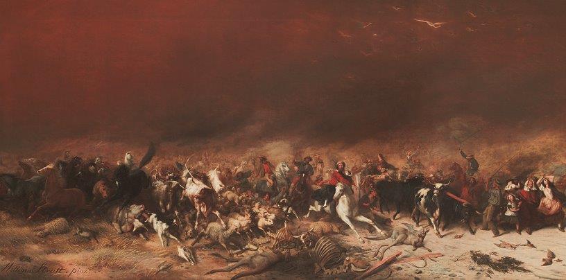
Some fifty years before the arrival of the Europeans at Botany Bay, a war party set out from what is now Gunnedah. Their target was a strong Aboriginal group on the nearby Tablelands near modern Bundarra. The Bundarra mob was probably Anaiwan, for it had different weapons and seems to have spoken a different language from the Kamilaroi (Gamilaraay) speaking war party.

The Bundarra group had been raiding for women in an arc stretching from Goonoo Goonoo to Manilla. The Gunnedah mob had been left alone because of their strength, The raids led the groups from Goonoo Goonoo and Manilla to seek support from Kamilaroi war leader, the Red Kangaroo. Having taken control from the previous elders, he had built the Gunnedah mob up into a strong force by absorbing other groups. The Red Kangaroo argued that support should be provided because the power of the Bundarra mob posed a threat. A joint war party was formed that defeated the Bundarra group, although the result was initially in doubt. The case shows how political alliances were formed and used in Aboriginal Australia. (Michael O’Rourke, “Sung for Generations”, published by the author, Canberra 2005, pp 306-311).

Track forward 200 years. An Aboriginal woman recalled that her grandmother told her all her life not to mix with coastal people, they were never to be trusted. Axes from the last great Aboriginal battle in Armidale fought near the present day teachers college have been sourced to the Armidale area (Anaiwan speakers) and Walcha (Dainggatti speakers whose main territory was the Macleay Valley). When Anaiwan people went to Inverell for ceremonies, they always camped as close to their own boundaries as possible – they were not liked by Kamilaroi people, but kinship ties brought them together for important occasions. (Sue Hudson). This pattern in group gatherings of camping on the side nearest to home territory was common.

Aboriginal life was not all warfare, although there was more fighting than is commonly believed today. However, the examples give a hint of some of the complexities of Aboriginal society.

What’s in a name?

This is the Nganyaywana or Anaiwan welcome to country as presented by Steve Widders:

Yugga danya Ngawanya -I am a Man of the Anaiwan people.

Roonyahra tanya tampida Ngawanya - This is the ancestral land of the Ngawanya.

Ootila tanya yoonyarah -I welcome you to this land.

Note the importance placed on land. Note, too, that you already have three different names for the same language. In fact, there are far more than three. This confuses people. Certainly it confused me when I first became interested in Aboriginal history.

Confusion drops away if you remember a few things.

In 1788 there were perhaps 250 Aboriginal language groups in Australia incorporating perhaps 700 dialects[i]. Language patterned the continent in a complicated mosaic reflecting geography as well as Aboriginal history and social structures.

These various Aboriginal languages were not written. European observers trying to capture names of groups in English wrote the same word in different ways. Then, too, people describe themselves and their neighbours in different ways depending on the question. Those descriptions are simply labels. Some say I come from this place, others say that is what we call them or that is what we call ourselves.

With so many languages labelled in so many ways, you can see how confusion might arise. There is another problem. The way we think today with our fixed boundaries and hard edged labels is quite alien to the Aboriginal view of the world. Their world was structured in a very different way, leading to further confusion in question and answer.

Within this language diversity, the dominant language grouping is called Pama-Nyungan. Coined by the linguist Kenneth Hale from the words pama (person in Cape York) and nyunga (one in south western Australia), Pama-Nyungun languages have commonalities in the structure of words and the way words to relate to each other

Our records of the Anaiwan language are skimpy. For a long time, it was seen as a very distinct language, different from the languages surrounding it and those elsewhere on the continent. It took the pioneering work of linguist Terry Crowley to show that Anaiwan was in fact related to adjoining languages.[ii]

The Anaiwan, the name I shall use for the sake of simplicity, were not confused. They knew their world and their place in it.

The importance of geography

Geography, land and climate, is central to the story of the Anaiwan. The broader New England that I write about consists of the Tablelands and the rivers that flow to the north, south, east and west. East to west, the humid coastal zone ends in the escarpment from which the Tablelands slope gradually to the west becoming the slopes and then the plains. North-south, both the humid coastal zone and the western slopes and plains are broken up by a series of river valleys. Climate varies east to west and, to a lesser extent, north to south.

When did the Anaiwan come to New England?

The first European settlers arrived at Botany Bay in 1788. By then, New England’s Aboriginal people may have occupied the territory for as much as 30,000 years.

We do not have hard evidence for this date. The earliest confirmed date in New England itself comes from a dig by Graham Connor at Stuarts Point in the Macleay Valley. This places human occupation at 9,320 +/- 160BP[iii]. Further north in South-East Queensland, the Wallen Wallen Creek site shows continuous occupation from about 20,000 years ago.[iv]

We know from dating at Warren Cave in Tasmania that the Aborigines had reached Tasmania around 35,000 years ago, while dates from Willandra Lakes in South West New South Wales suggest occupation as early as 41-40,000 years ago[v]. Given these dates, it seems reasonable to assume a working date of around 40,000 years ago for first Aboriginal occupation of New England.

The Cuddie Springs site near Brewarrina is especially interesting because it suggests occupation as long ago as 35,000 years BP.[vi] However, dates here have been subject to considerable dispute and there presently appears to be no agreement on the issue.[vii]

Despite the absence of earlier dates, it is hard to believe that the Aborigines had not reached New England if they were at Willandra Lakes around 40,000 years ago, had reached the southwest of what is now Tasmania by at least 35,000 years ago.

What type of world did they find?

Sea levels fluctuated greatly during the long Pleistocene period. Forty thousand years ago, sea levels were perhaps 50 metres below current levels, creating a broader coastal plain. Rainfall was high, temperatures moderate. Rivers running east and west from the Tablelands would have carried substantial volumes of water.

In the east, the river estuaries and wetlands as we know them today did not exist, nor did bays and harbours such as Trial Bay or Port Stephens[viii]. The present sea bed drops reasonably sharply in spots, so there would probably have been a significant gradient towards the sea with current headlands standing out as hills or ridges.

The significant volumes of water carried in the eastern flowing streams would have led to some progradation pushing the land out into the sea. With time, this would have led to river estuaries, coastal dunes and marshes. It seems likely that the larger coastal strip was thickly wooded and reasonably rich in marine and land resources.

In the west, the rivers and associated wet lands would also have provided a rich environment., although probably not as rich as it was to become.

The position on the Tablelands is unclear because so much of the analysis that I have seen deals with later periods. I suspect that the Tablelands were wooded and at least visited by surrounding groups.

The size and distribution of the early Aboriginal population is obviously unknown since at this stage we have yet to prove that they even existed. My own feeling is that it was probably much smaller but mirrored the pattern at the time the Europeans arrived; higher concentrations on the coast and on the western slopes and immediate plains, sparse on the Tablelands.

From around 36,000 years ago, the climate became cooler and drier. The cooler temperatures offset the lower rainfall by reduced evaporation; the streams, lakes and wetlands of inland New England therefore retained their water, providing a continued base for Aboriginal occupation.

From perhaps 25,000 years ago, the local environment deteriorated significantly. Sahul, the name given to the continent that then included Australia and New Guinea, became very dry, both intensely hot and intensely cold. This climatic regime peaked during what is called the Last Glacial Maximum, 21,000 to 15,000 years ago.

The sea retreated to perhaps 120 metres below current levels. The sea became colder, 2-4 degrees C below current levels. On land, mean monthly temperatures probably fell by 6-10 degrees C. Extensive inland dune building suggests that the climate become much windier.

According to Mulvaney and Kamminga, severe cold, drought, and strong winds over central and southern Sahul, would have discouraged tree growth , although some species common today must have survived in sheltered or better-watered refuges.[ix]

The retreating sea would have progressively increased the size of New England’s coastal strip. The impact here would have varied along the coast, depending upon water depth. In broad terms, the immediately adjacent shallow water to the east of the present coast is quite narrow, with the continental shelf then falling away sharply.

In South East Queensland to the north, the falling waters probably extended the coastal strip to between twelve and twenty kilometres east from what is now Stradbroke Island.[x] Further south the lower water zone narrows, before widening a little after what is now Nambucca. In the case of what is now the Macleay Valley, the coast line probably extended ten to sixteen kilometres to the east.[xi]

The sclerophyll woodland and deciduous forests would have progressively colonised the new land, with the coastal dunes and associated wetlands following the shifting coast east.

The Tablelands would have been a very different story. Here average temperatures fell by perhaps 8 degrees C. The New England Tablelands marked the start of a region of cold steppe and scattered sub-alpine woodland sweeping down through the southern Snowy Mountains[xii] into Tasmania.

In the southern Snowy Mountains, the fall in temperature was sufficient to allow glaciers to form despite the lower precipitation. In New England, the higher portions of the Tablelands in the centre and south where average heights are around 1,300 metres must have been very cold, dry and windswept. Along New England’s Snowy Mountains where the highest peak (Round Mountain) is almost 1,600 metres, there were probably blizzards and semi-permanent snow despite the much lower precipitation.

To the west, Mulvaney and Kamminga suggest that much of the south-eastern interior of Sahul experienced cold arid conditions similar to modern Patagonia[xiii].

Josphine Flood notes that the pollen record for Cuddie Springs on the Western Plains shows decreasing tree, shrub and grass cover with a rise in saltbush (Chenopodiaceae) suggesting growing aridity as the as the glacial maximum approached[xiv]. She suggests that the environmental record for Ulunga Springs, 180 kilometres southeast of Cuddie Springs, shows a similar pattern between 30,000 to 10,000 BP. The net effect was an expansion of the continent’s arid core by at least 150 kilometres.

That said, the lower western Tablelands and slopes were probably vegetated by grassland with spring herbs with patches of woodland and forests. Further west, the streams crossed the arid plains.

While these changes took millennia and would not have been noticeable to individual generations, the effect on the human population must have been quite severe.

Water and food supply were two of the critical determinants of prehistoric demography. Water became scarcer, droughts more frequent. Food supply was reduced. Over time, populations would have been forced to relocate and may well have become much smaller.

In the absence of archaeological evidence, it is impossible to say just what the precise effects were in New England. While colder and drier, there would have been sufficient water and food resources to maintain populations

We know that there was Aboriginal occupation of the coastal strip given that the Wallen Wallen site in South East Queensland shows continuous occupation from 20,000 years ago, a date in the earlier part the Late Glacial Maximum. It is reasonable to assume that any occupation on at least the majority of the Tablelands ceased. But what happened further west?

Under current climate, Northern NSW is generally wetter and warmer than Southern NSW because the area is affected by two different weather patterns. Rainfall also declines to the west because of the impact of the Eastern Ranges.

The climate during the Late Glacial Maximum was clearly very different. However, my feeling is that the current pattern was replicated to some extent because of air flows from what is now the Pacific.

In later times, ethno-historical evidence suggests that the presence of standing water was very important[xv]. During wet periods, people moved out into the broader landscape, concentrating round permanent water during dry periods.

With diminished rainfall but also lower temperatures, it seems likely that there were areas on the Western Slopes and Plains that would have continued to provide sufficient water and food to maintain life. Why, then, is there still no archaeological record? It seems likely that any previous human occupation of the Tablelands would have come to an end, although people may still have visited the lower areas.

Assuming that the area was populated, the pattern of sites would have reflected then on-ground conditions. Many of the sites would have been camping sites, not easily identifiable beyond lithic scatter. Other sites would have reflected the then location of permanent water.

My feeling is that we need to chart what the landscape was like then to identify possible sites. Mind you, this may already have been done and I have simply not discovered the analysis.

Holocene New England

After 6,000 years of cold, dry temperatures, the Late Glacial Maximum began to ease from around 15,000 years go. From around 12,000 BP, the period now described as the Holocene began with warming temperatures and higher rainfall-that reached something approaching today’s levels.[xvi] Tropics monsoons increased, then between 10,000 to 3,000 years ago summer rainfalls over much of Australia exceeded modern levels, leading to rising lake levels.

Around 8,700 years BP what has been called the Holocene Warm Maximum began. This lasted until 6,000 years ago, and possibly until around 4,500 BP. Mean annual average temperatures were 0.5C

Where did the Anaiwan live?

The attached map shows Aboriginal language map

My original research on New England’s Aborigines suggested that the Tablelands had a smaller population than surrounding areas because of a smaller resource base, It was also a marchland area whose population was squeezed between the Kamilaroi on one side, the big coastal language groups on the other[xvii]. While one element of my thinking, the movement of people off the Tablelands during winter, has been disproved[xviii], I think that the marchland element remains true.

To extend this point, consider the language pattern shown on the map. Both the Ngarabal and Nganyaywana occupy territories that are longer north-south than east-west. This pattern increased the range of language groups that they were in contact with. This meant in turn that Tablelands’ Aborigines mixed with quite different groups depending on just where they lived. Given the nature of interactions in Aboriginal society, this affected both language and the patterns of life.

The first reference we have to the Anaiwan language is William Gardner’s (1854) Ennewan[xix]. Norman Tindale (1974) recorded the location of the Anaiwan language group as occupying the New England tableland from Guyra and Ben Lomond south to Uralla and Moombie Range; north to Tingha; at Bendemeer and Armidale. He listed a variety of different spellings of the name: Anaywan, Anewan, Nowan, Enni-won, Yenniwon, Ee-na-won, En-nee-win, Eneewin, Inuwan, Inuwon, Nee-inuwon, Enuin.

Defined in this way, the Anaiwan adjoined the Kamilaroi to the south west and west, the Ngarabal to the north and the Gumbaingirr, Dainggatti and Biripi to the East.

By contrast, The Encylopedia of Aboriginal Australia (1994) follows these boundaries, but classifies the language spoken as Nganjaywana. This name (ng+anaywana+a) was originally coined by linguist Terry Crowley.

Reading the sorces, I found the varying descriptions of Anaiwan confusing and contradictory. At this point, I want to delineate some things that can be said with a reasonable degree of cetainty. In some doing, I am especially guided by the 1978 analysis of Bill Hoddinnott.[xx], although my analysis is not quite the same.

To begin with, I think that we can reasonably think of Anaiwan as a single language, although it varied greatly from north to south. Here I follow Tindale and Wafer and Lissarrague (2008:199-200) rather than Crowley, in part because of geography, in part because Crowley himself concluded that the northern and southern languages had a 65 per cent common lexicon.

In the north, Crowley suggested that the language north of Armidale around Tingha, Wandsworth, Ollera, Black Mountain and Guyra described by McPherson as Enneewin was not the same as that further south because it included lexical items borrowed from Gumbaingirr, whereas the language further south did not.

It makes perfect sense that Enneewin or Northern Anaiwan should be a distinct dialect with Gumbaingirr inclusions. Enneewin territory is bounded on the east by the watershed. Around this point is to be found the junction between those speaking Northern Anaiwan and the Baanbay dialect of Gumbaynggir. There is, however, something of a conundrum here in terms of the relationships between languages and water sheds. Mathews (1903) speaks of the territory of the Baanbay in terms of Guyra, Ben Lomond, Wollomombi, and Kookarabooka (Kookabookra). Wollomombi and indeed Guyra itself are in the Macleay River catchment, the area occupied by the Daingatti language group. However, the Macleay River tributaries have cut great gorges into the Tablelands such as that at Wollomombi; access is in fact easier from the north.

To the south of suggested Enneewin territory is a mountainous divide – known today as the Devil’s Pinch - separating the higher Tablelands around Guyra from the Tablelands north of Armidale. While geographic barriers were less important to those travelling on foot, it seems reasonable to think that the Enneewin Aborigines looked to the west, perhaps east, rather than the south.

Moving south, we come to territory clearly bordered by the Dainggati. Now the links depend upon ease of access. Walcha itself appears to have been Dainggati language country[xxi], while there are clear links in historical times between Armidale and the Macleay Valley. Reflecting this, Southern Anaiwan displays Dianggati influences.

The Northern Tablelands continues in a long sweep south of Walcha. This territory joins with another language group, the Birpai or Gadhang, with the Gamilaraay on the western side. In the far south, interconnections with the Hunter Valley languages are possible.

How did the Anaiwan live?


[i] The introductory overview material is drawn especial from John Mulvaney & Johan Kamminga, Prehistory of Australia, Allen & Unwin, Crows Nest, 1999 pp 69-75; and Peter K Austin, Article MS 1711 Countries and language – Australia, Encyclopedia of Language and Linguistics ELL2, pp 2-9,. accessed on line 19 August 2009

[ii] W G Hoddinott, The languages and myths of the New England area, in Isabel McBryde (ed), Records of times past: Ethnohistorical essays on the culture and ecology of the New England tribes, Australian Institute of Aboriginal Studies, Canberra, 1978, pp 52-64, pp 56-57.

[iii] G Connah, Archaeology at the University of New England 1975-76, Australian Archaeology, No 5, 1976, PP1-5.

[iv] Ian Walters, Antiquity of Marine Fishing in South-East Queensland, QAR, Vol 9, 1992, pp35-39. P35. Accessed on line 4 April 2009.

[v] Mulvaney & Kamminga, op cit, p197. There is debate about the Wilandra Lakes dates, with some arguing for older dates. Josephine Flood, Archaeology of the Dreamtime, J.B. Publishing, Marleston, revised edition, 2004, p1.

[vi] Josephine Flood, Archaeology of the Dreamtime, J.B. Publishing, Marleston, revised edition, 2004, p189.

[vii] The Wikipedia article, Cuddie Springs, provides an interesting discussion on this issue. Accessed 15 April 2009.

[viii] The analysis here is based on an assessment of the present coastal boating maps accessed 15 April 2009. A full assessment would require analysis of broader maps indicating varying depths of the sea bottom, allowing a better assessment to be made of the outer coastal strip..

[ix] Mulvaney & Kamminga, op cit, p116

[x] Flood, op cit, p113

[xi]

[xii] I have used the term southern Snowy Mountains because New England has its own smaller range also called the Snowy Mountains.

[xiii] Mulvaney & Kamminga, op cit, p117

[xiv] Flood, op cit, p192. .

[xv] J Belshaw Population distribution and the pattern of seasonal movement in northern New South Wales. In I. McBryde (ed.), Records of Times Past, pp.65-81. Canberra: Australian Institute of Aboriginal Studies, 1978

Notes on References

McBryde, I.1976. Seelands and Sai Yok Pebble Tools: A FurtherConsideration, Australian Archaeology, No 4, 59-73. Archived at Flinders University: dspace.flinders.edu.au

Hiscock, P. 1994 Technological responses to risk in Holocene Australia. Journal of World Prehistory 8(3):267-292.) On-line

[xvi] The base description on Holcene climate is drawn from John Mulvaney & Johan Kamminga, Prehistory of Australia, Allen & Unwin, Crows Nest, 1999, pp223-226.

[xvii]

[xviii]

[xix] O’Rouke p 47

[xx] Hoddinott, op cit, pp 55-57.

[xxi] Jillian Oppenhiemer, pers com.

Tuesday, September 11, 2012

The story will continue

I expect to continue my posts on Aboriginal New England shortly. In the meantime, and it's connected, my train reading has been Bill Gammage's The Biggest Estate on Earth: How Aborigines made Australia - Train Reading - introducing Gammage's The Biggest Estate on Earth. Bill writes from a continent perspective, whereas my focus is more area specific. Yet he includes a quantity of New England material that fits very nicely with what I want to write.

Tuesday, August 21, 2012

Aboriginal New England to 1788 1 - the story starts

This series examines Aboriginal life in New England up to the arrival of the first European settlers at Botany Bay in 1788. By then, the Aborigines had been living in the area that would be called New England for millennia. We don't know when they first arrived, but my present best  guess is that the most likely date is something over 30,000 years ago. 

I chose 1788  as a cut-off date to avoid becoming entangled in, twisted by, the events that were to follow. We know what is coming, but we have to put this aside. Our story is of people as they were, not what they would become. Our knowledge of the future means that we know that storm clouds are looming over the bright sun of the Aboriginal present, yet we mustn't lose sight of the sun.

You won't yet find the story that follows in these posts in any book, although parts are covered.  The material that I am drawing from comes from the first third of the book I am writing on the broader history of New England. My work is halting, imperfect. The book haunts me, for the project is many, many, years old now and yet seems as far from completion as ever. I have aged with the book and sometimes wonder if I will ever finish!

To my mind, it is better to put some of the material out there now rather than to wait. There is a story to tell and I will try to tell it as best I can. You must judge whether I have been successful. Can you see, hear and even smell the world of Aboriginal New England as the eucalyptus scented smoke drifts into the night air from the fire in the centre of the camp, rising in the cold night air towards the sandstone edge stark against the brilliantly starlit bowl  of the sky?

The place is now called Graman, not far from modern Inverell. The year is say 100 BC or, in current parlance, 100BCE. By now, the people who would be called the Aborigines have been camping here for at least 3,000 years. Down towards the creek, the grooves made in the rock from grinding stone tools are hidden in the dark.  The ceremonial rock shelters with the paintings and sculptures are hidden in the dark.

It can get cold at night here, even in summer. Away from the fire breath mists in the air. The camp is neat, the kit stowed. The men yarn quietly, talking among themselves, telling stories, some true. The talk is of day to day things. The camp falls silent as people make their way to bed. Tomorrow it is time to move along well known paths.  

Saturday, August 11, 2012

1258 volcanic eruption triggers global disaster

Fascinating piece in the Guardian on Facebook: "Mass grave in London reveals how volcano caused global catastrophe". The story begins:

Scientists search for the explosive source of a disaster that wiped out almost a third of Londoners in 1258

When archaeologists discovered thousands of medieval skeletons in a mass burial pit in east London in the 1990s, they assumed they were 14th-century victims of the Black Death or the Great Famine of 1315-17. Now they have been astonished by a more explosive explanation – a cataclysmic volcano that had erupted a century earlier, thousands of miles away in the tropics, and wrought havoc on medieval Britons.

The photo shows the huge excavation carried out by the team from the Museum of London Archaeology.

It's an interesting story, for it was the radio carbon dating of the bones to around 1250 that showed that the deaths could not have been caused by either the black death or the great famine of 1315-17. Another explanation had to be found.   

Writing in 1258, a monk reported:

"The north wind prevailed for several months… scarcely a small rare flower or shooting germ appeared, whence the hope of harvest was uncertain... Innumerable multitudes of poor people died, and their bodies were found lying all about swollen from want… Nor did those who had homes dare to harbour the sick and dying, for fear of infection… The pestilence was immense – insufferable; it attacked the poor particularly. In London alone 15,000 of the poor perished; in England and elsewhere thousands died."

It appears from further investigation including geological data from across the globe that this human catastrophe was cause by a huge volcanic eruption somewhere in the tropics up to eight times larger than that at Krakatoa (1883).  Now Krakatoa was a pretty big bang. I find it hard to imagine something up to eight times as large!

According to Volcanologist Bill McGuire:

"This was the biggest eruption in historic times. It may have brought the temperatures down by 4°c, a huge amount. Because it was somewhere in the tropics it meant that the winds of both hemispheres were able to carry these gases right across the planet. If you have a volcanic eruption at high latitudes, then the gases will stay in the northern hemisphere. But if you have an equatorial or tropical eruption that's big enough, then the sulphur gases can spread into both hemispheres and really encircle the whole planet in a sulphurous veil."

The reference to the global impact caught my eye, for this means that it would have affected Australia's Aboriginal peoples, including those living in New England. Intuitively, the relative impact wouldn't have been as great because of lower population densities. Still, it's interesting in the context of some of the thinking I have been doing about the patterns of Aboriginal life.