Discussions on the history and historiography of Australia's New England

Showing posts with label Prehistoric New England. Show all posts

Wednesday, May 06, 2020

The Aboriginal peopling of New England. Reoccupation following the ending of the Last Glacial Maximum


Stuart’s Point today, the site of the oldest known Aboriginal occupation in New England following the end of the Last Glacial Maximum This is the sixth and final in a series on the Aboriginal peopling of New England drawn from the introductory course I have been running on New England's history. I will continue the story of the Holocene period in a later series.   

In my last column I discussed the likely impact of the Last Glacial Maximum (LGM), a cold dry windy period running from around 12,000 to 15,000 years ago, on New England’s Aboriginal peoples.

Faced with persistent drought and temperatures up to 8C below present, New England’s Aboriginal peoples were forced to retreat to refuge areas where food as well as protection from the elements was still available. Whole groups may have been wiped out.

Around 15,000 years ago, the LGM began to ease. From around 12,000 years ago, the period now described as the Holocene began. Average temperatures rose, rainfall increased. Deserts retreated westwards, while plants, animals and humans began to reoccupy the landscape.

This process took time, while its effects varied from place to place.

Down on our coastal strip, sea levels rose by 130 metres rushing inland past the coastline we know today. If you were standing where Kempsey is now, you would be on the coast. Shelters, camping grounds, ceremonial sites and food resources were submerged by the rising waters.

Slowly, the silt laden rivers swollen by higher Tablelands’ rainfall pushed back, joined by sea currents depositing sand, creating the current coastal dunes and backing estuaries.

This process took time. The coast as we know it today finally emerged about 6,000 years ago.

Even before this date, new habitats emerged favourable to human occupation.

In 1975 excavations at Stuarts Point, a very large oyster and cockle midden on the inner barrier north of the present estuary of the Macleay, revealed an occupation date of 9320 ± 160 BP (Before Present). Prior to that result, the earliest coastal date had been 6444 ± 74 BP for the basal levels of the Seelands dig in the Clarence about 12 kilometres northwest of Grafton.

On the Western Slopes and Plains, the earliest certain occupation date we have is much later than the coast, with an uncalibrated age of 5450 ± 100 years BP at Graman near Inverell.

On the Tableland, the earliest certain occupation date that we presently have is an uncalibrated age of 4300 years ago from Bendemeer. However, analysis done by Wendy Beck suggests that the resource base would have allowed targeted visits from at least the start of the Holocene, with permanent settlement possible from perhaps 6,000 years.

It is frustrating that we cannot sketch out the story in more detail. What we can say with a degree of certainty is that New England’s Aboriginal peoples were entering a golden age that would last to European invasion.

I will tell you this story in a later series of columns.
This post was prepared as a column for the on-line edition of the Armidale Express. I am repeating the columns here with a lag because they are not all on line outside subscription. You can see all the Belshaw World and History Revisited/History Matters columns by clicking here for 2009, here for 2010, here for 2011, here for 2012, here for 2013, here for 2014, here for 2015,  here for 2016, here  2017, here 2018, here 2019, here 2020 

Wednesday, April 29, 2020

The Aboriginal peopling of New England. How the New England landscape went through dramatic changes


The Byron landslip scar. This is the fifth in a series on the Aboriginal peopling of New England drawn from the introductory course I have been running on New England's history.

Aboriginal oral tradition records memories of great floods as the sea rushed in. These are usually attributed to large scale sea level rises as the icy conditions of the Last Glacial Maximum (21,000 to 15,000 years ago) eased and sea levels rose.

I suspect that’s broadly true, but they may also included memories of submarine landslide induced tsunamis, many of which occurred over the last 25,000 years along the Southern Queensland and Northern NSW coasts.

These tsunamis came about because of land collapses along the steeply sloping continental shelf. These collapses sent great blocks of rock and sediment plunging down the steeply sloping shelf out to sea over distances up too 100km and depths of 3,000m. You can imagine the effects on sea levels.

While spectacular, these changes were only a small part of the challenges faced by Australia’s Aboriginal peoples.

In my last column, I discussed what the Aboriginal occupation of New England might have looked like perhaps 40,000 years ago.

The Aborigines had arrived on the ancient content called Sahul at a time when the climate was colder but damper.

From perhaps 25,000 years ago, the environment deteriorated significantly.

Globally, the ice spread. As it did, the climate became colder and drier, deserts spread and trees retreated. This climatic regime peaked during the Last Glacial Maximum 21,000 to 15,000 years ago.

Sahul became very dry, both intensely hot and intensely cold. Sea levels fell by 60+ metres to perhaps 130 metres below current levels. Sea temperatures fell to 2-4 degrees C below those of today.

The effects across New England were dramatic. In the west, there were cold arid conditions. The deserts expanded eastwards. Stream flow was reduced. Trees and animals retreated.. In the east, the falling sea levels revealed a rugged inhospitable shore. While the coastal areas remained relatively well watered, food resources would have been reduced.

On the New England Tablelands, average temperatures fell by perhaps 8 degrees C. The Tablelands marked the start of a region of cold steppe and scattered sub-alpine woodland sweeping down through the southern Snowy Mountains into Tasmania, making it an inhospitable region for human habitation.

Faced with these changing conditions, the Aborigines would have been forced to retreat to refuge areas where food was still available. Some groups would have perished.

Better conditions lay ahead, but challenges had to be surmounted first.
This post appeared as a column in the on-line edition of the Armidale Express on 23 April 2020. I am repeating the columns here with a lag because they are not all on line outside subscription. You can see all the Belshaw World and History Revisited/History Matters columns by clicking here for 2009, here for 2010, here for 2011, here for 2012, here for 2013, here for 2014, here for 2015,  here for 2016, here  2017, here 2018, here 2019, here 2020 

Wednesday, April 22, 2020

The Aboriginal peopling of New England - What did Aboriginal life look like in New England 40,000 years ago?


Over c48,000 years, Tableland lagoons such as Little Llangothlin have provided a potential resource for Aboriginal people. This is the fourth in a series on the Aboriginal peopling of New England drawn from the introductory course I have been running on New England's history.

In my last column I suggested that while we had no direct archaeological evidence, the pattern of archaeological dates across Sahul suggested that first Aboriginal occupation of the broader New England may have taken place around 40,000 years ago.

Given the present absence of archaeological evidence, what might this occupation have looked like? To start answering this question, we need to start with New England’s geography.

In the east, the coastline as we know it today with its rich estuarine and marine resources did not exist and would not do so for another 34,000 years.

Sea levels were 60 metres lower than present. Because the continental shelf in this part of Australia is generally relatively narrow and steep sloping, the land revealed by the lower waters was often rugged, falling away to the then coastline,

The rivers from the Tablelands that now meander to the sea would have been faster flowing, their courses straighter with smaller estuaries. However, while the coastal environment was not as rich as it would later be, the combination of coastal, riverine and land environments would have been sufficient to support human occupation.

Inland, the Western Slopes and Plains would have been relatively well watered and potentially rich in resources. Again, it seems unlikely that the area was left vacant.

Further force is provided to this tentative conclusion in that in moving south whether by the inland or coastal routes, the advancing Aborigines would have passed through the broader New England. 

But what about that bit in the middle, the New England Tablelands? This was a less rich area in food terms, making occupation less likely.

In the absence of early dates, Wendy Beck, Robert Hayworth and John Appleton examined what resources might have been available to the Aborigines on the New England in the lagoons that run along the spine of the Tablelands.

The lagoons and especially Little Llangothlin have been studied because their long existence (c48,000 years) provides a useful record of change over time. They concluded that the combination of megafauna with lagoon resources could have provided a base for at least seasonal visits.

All this is surmise based on circumstantial evidence. We may never know because of the scale of changes that have taken place over the last forty thousand years. On the coast, for example, changing sea levels mean that many potential occupation sites have been buried under water or later silt deposits.

Despite such problems, I do believe that we can learn more through the type of studies pioneered by Wendy and her colleagues.
Note to readers: This post appeared as a column in the on-line edition of the Armidale Express Extra on 17 April 2020. I am repeating the columns here with a lag because they are not all on line outside subscription. You can see all the Belshaw World and History Revisited/History Matters columns by clicking here for 2009, here for 2010, here for 2011, here for 2012, here for 2013, here for 2014, here for 2015,  here for 2016, here  2017, here 2018, here 2019, here 2020 

Wednesday, April 15, 2020

The peopling of New England - Aboriginal people's arrival in New England


Aboriginal settlement of Sahul: by 40,000 years ago, the ancestors of Australias Aboriginal peoples had occupied the entire continent known as Sahul. This is the third in a series on the Aboriginal peopling of New England drawn from the introductory course I have been running on New England's history.

If the ancestors of Australia’s Aboriginal peoples reached the large continent known as Sahul perhaps 65,000 years ago, how and when did they reach the broader New England?

To start answering this question, consider the illustration to this column from Alana Coper et al. It shows the land boundaries of the mega-continent of Sahul during the Last Glacial maximum when sea levels were much lower.

The red lines suggest possible settlement paths; the black dates archaeological dates where kya stands for a thousand years. Ignore the other elements.

The Aboriginal ancestors arrived in Sahul during the Pleistocene, a period of repeated ice ages broken by warmer periods. They arrived at a benign time with relatively comfortable temperatures and a higher rainfall sufficient to fill the lakes and rivers.

The archeological dates shown in black suggest that by 40,000 years ago the descendents of those first settlers had occupied the entire continent of Sahul from Papua and surrounding islands in the north to Tasmania in the far south.

The migration paths are subject to some dispute. One school of thought is that migration went down the east coast.

I disagree. I think that it is most likely that migration proceeded down the western slopes and immediate western plains where there was water and easier immigration paths.

Whatever the exact path, it seems clear that by 40,000 years ago Sahul was occupied. Herein lies a problem, for the dates we have for the broader New England are all later.

The Cuddie Springs site near Brewarrina suggests occupation as long ago as 35,000 years BP. However, dates here have been subject to considerable dispute.

Excluding Cuddie Springs, we have a date of greater than 20,200 years BP (Before Present) from a hearth at Glennies Creek 35 kilometres north of Branxton in the Hunter, while a site on a former terrace of Wollombi Brook near Singleton suggested a date range of 18,000-30,000 years BP. At Moffats Swamp near Raymond Terrace, a date of 17,000 years BP was obtained.

On the Liverpool Plains, Aboriginal occupation has been dated to at least 19,000 years BP. Further north in South-East Queensland, the Wallen Wallen Creek site on what is now North Stradbroke Island shows continuous occupation from about 20,000 years ago.

While these dates are all later, Aboriginal peoples moving south must have passed through the broader New England, so we can reasonably assume some Aboriginal occupation by at least 40,000 years ago, probably earlier.

In my next column, I will discuss what that occupation might have looked like. 
Note to readers: This post appeared as a column in the Armidale Express Extra on 8 April 2020. I am repeating the columns here with a lag because they are not all on line outside subscription. You can see all the Belshaw World and History Revisited/History Matters columns by clicking here for 2009, here for 2010, here for 2011, here for 2012, here for 2013, here for 2014, here for 2015,  here for 2016, here  2017, here 2018, here 2019, here 2020 

Wednesday, April 08, 2020

The peopling of New England - Mysteries of migration


Digging deep: Evidence from the Madjedbebe rock shelter suggests early occupation from 65,000 years ago plus or minus 5,000 years.This is the second in a series on the Aboriginal peopling of New England drawn from the introductory course I have been running on New England's history.

In my last column, I spoke of the mysterious Denisovans, a new hominid species only discovered in 2010. They are significant to Australian history because it is clear that the ancestors of both the Papuans and Australia’s Aboriginal peoples met and mated with them on their journey to Sahul, the name given to the continent of which both Australia and Papua New Guinea were once part.

Over the next few columns I will tell you a little of the remarkable story of Aboriginal occupation of Sahul, including New England. It’s a story still shrouded in mystery and uncertainty, but we know enough now to at least paint a broad picture.

We do not know exactly when the ancestors of Australia’s Aboriginal peoples arrived on Sahul. The earliest date we have comes from excavations at the Madjedbebe rock shelter in Kakadu near Jabiru. There earliest occupation was dated to 65,000 years plus or minus 5,000 years.

There have been some suggestions of earlier possible dates based on circumstantial evidence such as fire patterns. Most recently, an excavation at Moyjil Port Ritchie near Warnambool identified a possible hearth dating to 120,000 years ago. However, the team was cautious in their conclusions in the absence of any associated artefacts.

The evidence from Madjedbebe also suggests a sophisticated material culture from an early date. This is consistent with an emerging body of evidence that suggests that earlier hominin species including anatomically modern humans were far more advanced and at an earlier period than previously realized.

This bears upon the question of just how the ancestors of the Aboriginal and Papuan peoples reached Sahul.

The old view based upon then perceptions of “primitiveness” saw the original settlers almost as castaways, small groups who came by accident. This now seems highly unlikely and for two reasons.   
The first is that we now know that earlier peoples were far more capable of crossing open water than previously realized. The great voyages from East Asia into Polynesia are a later and very dramatic example.

The second reason is that population analysis suggests that the survival and then expansion of the early human occupants of Sahul required a minimum foundation population measured in at least the low thousands. To my mind, there are likely to have been a number of movements spaced over time, possibly using different paths.

We don’t know what caused these migrations.

It may have been because of population pressures on existing ranges or because of pressures created by in-migration from other groups. There may have been natural disasters or, perhaps, just the normal human spirit wishing to explore new territories.

We may never know the answers here. However, we do more about what happened once the Aboriginal ancestors reached Sahul.
Note to readers: This post appeared as a column in the Armidale Express Extra on 1 April 2020. I am repeating the columns here with a lag because they are not all on line outside subscription. You can see all the Belshaw World and History Revisited/History Matters columns by clicking here for 2009, here for 2010, here for 2011, here for 2012, here for 2013, here for 2014, here for 2015,  here for 2016, here  2017, here 2018, here 2019, here 2020 

Wednesday, April 01, 2020

The peopling of New England - the mysterious Denisovans


Neanderthal cousins: Artists reconstruction of a Denisovan girl based on the combination of skeletal and DNA evidence.This is the first in a series on the Aboriginal peopling of New England drawn from the introductory course I have been running on New England's history.

We all carry our ancestry within us, imprinted in our DNA. We all know this in part because it provides the base for the increasingly popular ancestry DNA tests. What is perhaps less recognised is the way in which the science of genomics has totally transformed our knowledge of the deep human past. 

Genomics, an interdisciplinary field of biology, focuses on the structure, function, evolution, mapping, and editing of genomes. A genome is an organism's complete set of DNA, including all of its genes.

Genomics allows us to map and compare DNA from even ancient specimens. It allows us to map changes over time, and to estimate when certain changes might have taken place. This has resulted in a knowledge explosion.

The mysterious Denisovans are a case in point.

Denisova Cave lies in the Altai Mountains in south-central Siberia near the border with Kazakhstan, China and Mongolia.

In 2010, a Russian team announced that the DNA analysis of a juvenile female finger bone from the site had revealed a new hominin species that they named the Denisovans after the cave. The Denisovans were cousins to the European based Neanderthals, but had separated from them several hundred thousand years before.

This was remarkable enough, but more was to follow. DNA analysis of other remains and of modern human populations suggested that the Denisovans were widely spread across Asia with two distinct lines, one in East Asia, a second in South East Asia.

Further, the results show that the Denisovans overlapped with the Neanderthals at Denisova and with both Homo Erectus and anatomically modern humans in East and South East. The widespread nature of the Denisovan trace in dispersed anatomically modern human populations suggests extensive interbreeding with multiple Denisovan populations.

The DNA analysis also revealed that in their long journey out of Africa to the ancient continent called Sahul, the ancestors of the Papuans and Australian Aborigines had met and mated with the Denisovans.

This mating probably took place in what is now South East Asia close to Sahul. However, the trace is so strong among Papuans that it raises the possibility that the Denisovans may have lived in Papua or nearby islands until as recently 30,000 years ago.

This date is well within the period of Aboriginal occupation of Sahul. It raises an intriguing question: if the Denisovans were in Papua, then the northern extension of Sahul, did they penetrate further south into what is now the Australian continent?

Note to readers: This post appeared as a column in the Armidale Express Extra on 25 March 2020. I am repeating the columns here with a lag because they are not all on line outside subscription. You can see all the Belshaw World and History Revisited/History Matters columns by clicking here for 2009, here for 2010, here for 2011, here for 2012, here for 2013, here for 2014, here for 2015,  here for 2016, here  2017, here 2018, here 2019, here 2020 


Sunday, April 28, 2019

The spreading Denisovans

This short piece by  Meilan Solly, in the Smithsonian ,The Hominins We’ve Been Calling Denisovans Are More Diverse Than Previously Thought, provides a very useful summary of current thinking.

So far the only Denisovan remains that have been found are from a cave in Siberia. But the DNA analysis suggests that their influence was wise spread, with several Denisovan groups.

The significance for New England history and the history of the Australian Aborigines in general is that while we now know that Aboriginal ancestors interacted with the Denisovans we do not know when and where. Had the Denisovans actually reached Sahul, prehistoric Australia, or was the interaction earlier. The second is the current view, in South East Asia.

The further back the dates of human occupation of Sahul are pushed, the more complex the story becomes. At 62,000 years, all things are (I guess) on the table.

Tuesday, May 08, 2018

Climate deteriorations and Neanderthal demise in interior Iberia - a note

Interesting paper by Wolf, Kolb et al on the impact of climate change and Neanderthal demise in interior Iberior. The abstract reads:
Time and circumstances for the disappearance of Neanderthals and its relationship with the advent of Modern Humans are not yet sufficiently resolved, especially in case of the Iberian Peninsula. Reconstructing palaeoenvironmental conditions during the last glacial period is crucial to clarifying whether climate deteriorations or competition and contacts with Modern Humans played the pivotal role in driving Neanderthals to extinction. A high-resolution loess record from the Upper Tagus Basin in central Spain demonstrates that the Neanderthal abandonment of inner Iberian territories 42 kyr ago coincided with the evolvement of hostile environmental conditions, while archaeological evidence testifies that this desertion took place regardless of modern humans’ activities. According to stratigraphic findings and stable isotope analyses, this period corresponded to the driest environmental conditions of the last glacial apart from an even drier period linked to Heinrich Stadial 3. Our results show that during Marine Isotope Stages (MIS) 4 and 2 climate deteriorations in interior Iberia temporally coincided with northern hemisphere cold periods (Heinrich stadials). Solely during the middle MIS 3, in a period surrounding 42 kyr ago, this relation seems not straightforward, which may demonstrate the complexity of terrestrial climate conditions during glacial periods. 
D. Wolf, T. Kolb, M. Alcaraz-Castaño, S. Heinrich, P. Baumgart, R. Calvo, J. Sánchez, K. Ryborz, I. Schäfer, M. Bliedtner, R. Zech, L. Zöller & D. Faust, "Climate deteriorations and Neanderthal demise in interior Iberia", Scientific Reports,volume 8, Article number: 7048 (2018) doi:10.1038/s41598-018-25343-6 Received: 20 September 2017, Accepted 17 April 2018, Published 04 May 2018
Discussion

One of the issues we have discussed here that also came up in discussion during my recent Armidale seminar paper is the need to properly understand local variations in climatic conditions during the Pleistocene and Holocene if we are to understand the Aboriginal history of New England.

This paper makes the same point in a different context. The abstract is fairly dry (the full paper is on-line: link above), but a key point from the paper can be summarised this way: interior Iberia (modern Spain) became very dry and inhospitable with reduced vegetation at particular periods. One period coincided with Neanderthal occupation. It seems that the Neanderthals were not wiped out,  but may have retreated to coastal refuge areas where conditions were more benign. .

During glacial periods, the climate became drier as well as colder because so much water was tied up in ice. However, there were considerable variations at local level. For example, research results from the Little Llangothlin lagoon on the high New England suggest local variations during the Late Glacial Maximum that do not quite fit with the conventional analysis.

I now have a mass of new reading to do and to report on!

Monday, January 22, 2018

Implications for New England of the latest analysis on the impact of sea level change on Aboriginal Australia - a note

Regular commenter JohnB pointed me to a new paper on historic sea level changes in Australia:  Alan N. Williams, Sean Ulm, Tom Sapienzab, Stephen Lewis and Chris S.M. Turneya, Sea-level change and demography during the last glacial termination and early Holocene across the Australian continent, Quaternary Science Reviews Volume 182, 15 February 2018, Pages 144–154, published on line 12 January 2018.

This third note on understanding the impact of sea level change in Aboriginal New England takes this paper as an entry point for a broader discussion focused on the impact of sea level and associated climatic changes on New England Aboriginal life.

Please note that I have not been able to access the full paper at this point for cost reasons. That will have to wait until I can find a library that will give me access. This is an especial problem for their population modelling.

The Williams et al Paper


Map of Australia by Sean Ulm showing sea-level change and archaeological sites for selected periods between 35,000 and 8,000 years ago. PMSL=Present Mean Sea Level. Note the apparently small shifts in Northern NSW relative to some other areas. . 

The on-line abstract of the paper summarises some of the paper in this way:
  • Investigation of scale, pace and human impacts of post-glacial sea-level change.
  • Presents continental-scale consensus sea-level curve for Sahul between 35-8 ka.
  • Demonstrates some 2.12 million km2 (∼21.6%) of land lost, notably during MWP-1a.
  • Coastlines changed on average by 139 km, and at a rate of up to ∼23.7 m per year.
  • Populations low, but likely severely disrupted, and led to new configurations.
The abstract of the paper reads:
"Future changes in sea-level are projected to have significant environmental and social impacts, but we have limited understanding of comparable rates of change in the past. Using comprehensive palaeoenvironmental and archaeological datasets, we report the first quantitative model of the timing, spatial extent and pace of sea-level change in the Sahul region between 35-8 ka, and explore its effects on hunter-gatherer populations. Results show that the continental landmass (excluding New Guinea) increased to 9.80 million km2 during the Last Glacial Maximum (LGM), before a reduction of 2.12 million km2 (or ∼21.6%) to the early Holocene (8 ka). Almost 90% of this inundation occurs during and immediately following Meltwater Pulse (MWP) 1a between 14.6 and 8 ka. The location of coastlines changed on average by 139 km between the LGM and early Holocene, with some areas >300 km, and at a rate of up to 23.7 m per year (∼0.6 km land lost every 25-year generation). Spatially, inundation was highly variable, with greatest impacts across the northern half of Australia, while large parts of the east, south and west coastal margins were relatively unaffected. Hunter-gatherer populations remained low throughout (<30,000), but following MWP1a, increasing archaeological use of the landscape, comparable to a four-fold increase in populations, and indicative of large-scale migration away from inundated regions (notably the Bass Strait) are evident. Increasing population density resulting from MWP1a (from 1/655 km2 to 1/71 km2) may be implicated in the development of large and complex societies later in the Holocene. Our data support the hypothesis that late Pleistocene coastal populations were low, with use of coastal resources embedded in broad-ranging foraging strategies, and which would have been severely disrupted in some regions and at some time periods by sea-level change outpacing tolerances of mangals and other near-shore ecological communities" .
The authors provided a summary of the  paper in The Conversation, "Australia’s coastal living is at risk from sea level rise, but it’s happened before",  January 16 2018. The map is from this paper.

Some of their key points can be summarised this way:
  • The potential impacts of these past sea-level changes on Aboriginal populations and societies have long been a subject of speculation by archaeologists and historians.
  • Archaeologists have long recognised that Aboriginal people would have occupied the now-drowned continental shelves surrounding Australia, but opinions have been divided about the nature of occupation and the significance of sea-level rise. Most have suggested that the ancient coasts were little-used or underpopulated in the past.
  • Our data show that Aboriginal populations were severely disrupted by sea-level change in many areas. Perhaps surprisingly the initial decrease in sea level prior to the peak of the last ice age resulted in people largely abandoning the coastline, and heading inland, with a number of archaeological sites within the interior becoming established at this time.
  • With the onset of the massive inundation after the end of the last ice age people evacuated the coasts causing markedly increased population densities across Australia (from around 1 person for every 355 square km 20,000 years ago, to 1 person every 147 square km 10,000 years ago).
  • We argue that this squeezing of people into a landmass 22% smaller – into inland areas that were already occupied – required people to adopt new social, settlement and subsistence strategies. This may have been an important element in the development of the complex geographical and religious landscape that European explorers observed in the 18th and 19th centuries.
  • Following the stabilisation of the sea level after 8,000 years ago, we start to see the onset of intensive technological investment and manipulation of the landscape (such as fish traps and landscape burning)
  • We also see the formation of territories (evident by marking of place through rock art) that continues to propagate up until the present time. All signs of more people trying to survive in less space.
But what is the evidence for New England?

Shape of the Continental Shelf

The effect of sea level change varies depending on the size of sea level shifts, shifts in land height as the land adjusts to things such as increased or reduced ice weight and the configuration of the land itself.

In my first note on the impact of sea level changes, I mentioned that I had only just found a 2010 paper: Alan Jordan, Peter Davies, Tim Ingleton, Edwina Foulsham, Joe Neilson and Tim Pritchard,  Seabed habitat mapping of the continental shelf of NSW, Department of Environment, Climate Change and Water NSW, Sydney 2010. This focuses on the current seabed habitat along the NSW, but it contains some of the best local descriptions that I have seen of the shape of the continental shelf itself in Northern NSW.

I am still working my way through this paper, but I would summarise some of the conclusions in this way. In considering them, remember that we are dealing with variations in sea levels over my study period from perhaps 50-60m below current levels to 120-130m below to perhaps 2m above and then a fall back to current levels. In combination with associated climatic changes, this would have had significant habitat changes for local Aboriginal populations as land was revealed and then submerged.

It will be clear from the Sean Ulm map reproduced above, that the effects of sea level changes along the NSW coast were smaller than in other parts of Sahul, but that doesn’t really provide much local information.
To further out thinking here, the overall width of the continental shelf is defined as the distance to the shelf break. From this point, the seabed falls away quickly. The shelf break occurs at varying heights, leading to variations in depth below current sea levels. The continental shelf slopes down from the current shoreline at varying angles. Higher land on the shelf may appear as reefs or islands.

The NSW study shows considerable regional variations in the depth of the shelf break and the certainty with which it can be defined. The shelf break between Cape Howe in the far south of NSW to Forster on the Mid North Coast varied predominantly between depths of 130–170m and gradually decreased in areas further north to depths of approximately 80–110m off the Northern Rivers.

During the LGM, sea levels dropped to 120-130m below current levels. In Southern New England up to Forster, the shelf break with its sharp decline in height would have remained largely below sea level, although it might have been quite close to the shore. Further north, the shelf break would have been marked by a line of cliffs or at least precipitous decline 15-50m above then sea level.

The study did not report on the 130m contour, focusing instead on the 200m contour deep zone. The distance to the outer edge of the 200-metre contour deep zone revealed the smallest zone widths of 13.4 kilometres and 13.9 kilometres were off Hat Head and Sawtell respectively. The broadest areas occurred off the Stockton Bight with a zone width of up to 46.7 kilometres.

The authors also looked at the extent of the intermediate-depth zone, 25–60m. This is significant because 60m below current is around the sea level when the Aborigines spread across Sahul. This ranged from 1.5 kilometres off Botany Bay, 1.6 kilometres off Shellharbour to 17.5 kilometres just north of Yamba.
The majority of wide (greater than 8 kilometres) intermediate-depth areas were located north of Hat Head, reflecting the overall shallower slope of the shelf in that region. The small number of wide intermediate areas south of Port Jackson mostly reflected the presence of shallow embayments and/or offshore reefs.

Some information was also provided on the shallow-depth zone boundary defined as 25m This was universally narrow along the NSW coast, varying between 0.3 kilometres off Sydney Harbour and Botany Bay to 3.5 kilometres off the Shoalhaven Bight south of Nowra. The width of the immediate-depth zones was more variable than the shallow-depth zones: 70 per cent of the widths of shallow-depth zones were between 0.8 and 1.8 kilometres whereas 70 per cent of widths for intermediate-depth zones were between 5 and 15 kilometres.

In considering this information, we need to remember that the coastal land as we know it today did not exist in the past, but has been formed in part by a constant battle between land and sea, the rivers and creeks depositing silt, the sea eroding the shore. Accepting this and very roughly :
·         We have a fall in height of 25m in the first 0.3-3.5 kilometres.
·         Followed by a further fall of up to 35m in the next 3.5-16 kilometres
·         With a further fall of 60-60m in the remaining distance to the LGM sea line.

If we take the period to the LGM, the additional land at then sea levels was most extensive in the Northern Rivers, narrowed south of Nambucca Heads before widening again. The delta-estuarine-lake formations that we know today and which were such rich environment in Aboriginal times did not exist. Lacking the accumulated sand and silt, land levels along much of the existing coastline would have been lower. The path of the rivers and streams would have been different, less meandering. They are likely to have been faster flowing given the slope of the continental shelf. The pre-LGM coastline was established for a considerable period. I do not know to what extent the rivers were able to create estuarine conditions, given the geography that I have described.

The land areas revealed by the LGM drops in sea levels were greatest in the north and south broken by the strip in the middle where the continental shelf is particularly narrow. With steeper slopes and colder temperatures it seems likely if not certain that the land, as suggested by Sandra Bowdler, became relatively inhospitable.[1] I say likely but not certain because of the degree of local variation, the possibility of micro-environments.

With the arrival of the warm Holocene, the seas rushed back, penetrating deep inland in some spots. You can get a feel for this is you remove all the present sand dunes, all the now accumulated silt and sand in the estuaries and flood plains, with a water level 1-2m higher than present sea levels. Now the streams and rivers carrying higher water volumes in the wetter climate began to push back against the seas, progressively creating the coastline we know today.

Archaeological Dates

We do not know when the Aborigines first settled the area that would later be called Northern NSW, the broader New England.

We know from dating at Warren Cave in Tasmania that the Aborigines had reached Tasmania around 35,000 years ago [2]while dates from Willandra Lakes in South West New South Wales suggest occupation as early as 40 to 41,000 years ago, perhaps even later[3]. The dates we have for New England are more recent.

The Cuddie Springs site near Brewarrina suggests occupation as long ago as 35,000 years BP.[4] However, dates here have been subject to considerable dispute and there presently appears to be no agreement on the issue.[5] Excluding Cuddie Springs, we have a date of greater than 20,200 years BP from a hearth at Glennies Creek 35 kilometres north of Branxton in the Hunter, while a site on a former terrace of Wollombi Brook near Singleton suggested a date range of 18,000-30,000 years BP. At Moffats Swamp near Raymond Terrace, a date of 17,000 years BP was obtained. On the Liverpool Plains, Aboriginal occupation has been dated to at least 19,000 years BP[6]. Further north in South-East Queensland, the Wallen Wallen Creek site shows continuous occupation from about 20,000 years ago.[7]

I note that there are some problems with these dates that I have not yet resolved. However, for present purposes it is the broad pattern that I am interested in.

Note, first, that the dates are late Pleistocene dates from the LGM period. However, there are no coastal zone dates from the Hunter to Wallen Wallen Creek. The entire Tablelands and much of the coast is presently an archaeological blank.

Wallen Wallen Creek lies on North Stradbroke Island, then part of the mainland some distance from the coast. The suggestion is that it was a transit camp for people moving to the coast. Something of the same may be true for Moffats Swamp which lies not far from the present coastline but would then have been some distance from the sea.  

The two other Hunter sites are further inland and could have been refuge areas with access to water and game. Richard Wright suggests that the Liverpool Plains was a relatively fertile area even during the harsh climatic conditions of the LGM, although he notes that there were periods when the climate did deteriorate significantly.[8]

Dates then seem to vanish. Then we have a first date of 9,320+/-160 from Stuart’s Point in the Macleay Valley as the coastal zone begins to stabilise.[9]. From around 4,000 years ago a rush of dates begins. Intensification had begun.

Discussion

Recognising that the continental shelf in New England is far narrower and therefore the scale effects of sea level change are less, my preliminary analysis does seem broadly supportive of the new paper, recognising that I have only read the summary. However, I do have some questions in my mind.:
To begin with, I am reluctant to accept that there were no Aboriginal people on the humid coastal strip between the Hunter and Southern Queensland. I think that we need a lot more micro or local level information on the changing environment including sea levels.

Then we have the language patterns. As best I understand it, the differences between the northern and southern coastal languages could support re-occupation from north and south. But then we have the problem of the length of time required for the languages to differentiate into the pattern that existed at the time of European occupation. I don’t have an answer for this.


[1] Sandra Bowdler, “The empty coast: Conditions for human occupation in southeast Australia during the late Pleistocene”. In O'Connor S, editor, Altered ecologies: fire, climate and human influence on terrestrial landscapes. Vol. Terra Australis; 32. http://epress.anu.edu.au: ANU E Press. 2010. p. 177-186.
[2] John Mulvaney & Johan Kamminga, Prehistory of Australia, Allen & Unwin, Crows Nest, 1999. P186.
[3] Munvaney & Kamminga, op cit, p197. There is debate about the Wilandra Lakes dates, with some arguing for older dates. Josephine Flood, Archaeology of the Dreamtime, J.B. Publishing, Marleston, revised edition, 2004, p1.
[4] Josephine Flood, Archaeology of the Dreamtime, p189.
[5] The Wikipedia article, Cuddie Springs, provides an interesting discussion on this issue. Accessed 15 April 2009.
[6] Dates drawn from Dominic Steele Consulting Archaeology, Preliminary Aboriginal Archaeological Survey & Assessment,  Proposed Upgrade of State Highway SH23, Shortland to Sandgate New South Wales, December 2005, p17
[7] Ian Walters, Antiquity of Marine Fishing in South-East Queensland, QAR, Vol 9, 1992, pp35-39. P35. Accessed on line 4 April 2009.
[8] Richard Wright, The Future of Australia's Prehistoric Past, Arts: The Journal of the Sydney University Arts Association, Vol 12 (1984). pp 22-34
[9] Graham Knuckey, A shell midden at Clybucca, near Kempsey, New South Wales, Journal, Australian Archaeology Volume 48, 1999 - Issue 1, pp1-11

Monday, December 18, 2017

Understanding the impact of sea level change in Aboriginal New England - a second note

This note briefly follows up on some of the issues I mentioned in Understanding the impact of sea level change in Aboriginal New England - a note.

Storegga Slides

In a comment on the post, JohnB referenced the three Storegga Slides, considered to be among the largest known landslides. Wikipedia states that they occurred under water, at the edge of Norway's continental shelf in the Norwegian Sea, approximately 6225–6170 BCE. The collapse involved an estimated 290 km (180 mi) length of coastal shelf, with a total volume of 3,500 km3 (840 cu mi) of debris, which caused a very large tsunami in the North Atlantic Ocean. In Scotland, traces of the tsunami associated with the last slide have been found, with deposited sediment being discovered in Montrose Basin, the Firth of Forth, up to 80 km (50 mi) inland and 4 m (13 ft) above current normal tide levels.

The Australian slides referred to in my note appear smaller, with the biggest one described as "several tens of kilometres across."  That would still have had a significant if more localised effect.

Climate Change and the Making of Britain. 

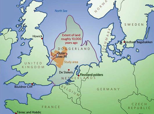
The last Storegga slide may have marked the final end of Doggerland (and here), the landbridge connecting England and the European mainland.

An brief article by Tate Greenhalgh and Lisa Hendry (The making of an island, Natural History Museum, 15 December 2017)  traces the interaction between climate, sea levels and Hominin occupation of what are now the British Isles over 950,000 years.

It's very simplified, but it is easy to read and provides an overview of the scale of change.

Post-glacial Sea Level Change in Australia

Following my earlier post, I found a very good review article, Lewis, S.E., et al., "Post-glacial sea-level changes around the Australian margin: a review", Quaternary Science Reviews (2012), http://dx.doi.org/10.1016/j.quascirev.2012.09.006.

It's a very interesting article because of the way it consolidates the current state of the research on the pattern of sea level change and the reasons for  local variations over the period from the lowstand during the Last Glacial Maximum through to the Holocene highstand and then the relatively slight fall to the standstill sea level around the present level. It fills another gap in my research.

JohnB wondered if memories of landslip induced tsunamis might be found in Aboriginal oral history. I don't know. However, in an earlier article in The Conversation ( Ancient Aboriginal stories preserve history of a rise in sea level, January 13,  2015) by Nick Reid  and Patrick D. Nunn concludes that the memory of the impact of the sea rise was preserved in Aboriginal oral tradition.  

Monday, December 11, 2017

Understanding the impact of sea level change in Aboriginal New England - a note


Underwater landslip on the downward slope of the continental shelf off Byron Bay. New research shows a large number of such slips, many of which have occurred in the last 25,000 years. These were within the period of Aboriginal occupation of New England, a time of great changes in sea levels.    

Interesting article in The Conversation (11 December 2017) by Samantha Clarke, Hannah Power, Kaya Wilson and Tom Hubble, Scars left by Australia’s undersea landslides reveal future tsunami potential on evidence for sometimes large underwater landslides on the downward slope where the continental shelf  falls away to deeper water. This diagram from the article illustrates the process.


The focus in the article is on tsunami risk from future landslips. However, I was interested both in the undersea pictures and the reference to frequency over the last 25,000 year for this was a period of substantial sea level change.

Pattern of Sea Level Change

Without bogging down in dates,  the last ice age began about 110,000 years ago. Sea levels fluctuated, falling during glacial periods, rising during warmer interglacial periods. Around 40,000 years ago, sea levels were perhaps 50 metres below present levels. From around 36,000 years ago, the climate became cooler and drier. Then from around 25,000 years ago the climate deteriorated very significantly with spreading ice sheets globally. This climatic regime peaked during what is called the Last Glacial Maximum (LGM), 21,000 to 15,000 years ago.

As more water turned to ice, sea levels fell significantly, bottoming around 18,000 years ago at perhaps 120-130 metres below present levels. At this height, parts of the continental shelf slope break line could have been 20-30 metres above water.

The LGM began to ease around 15,000 years ago. The North American ice sheets melted. Around 12,000 years ago, the Antarctic ice sheets began to shrink. The Holocene with its higher rainfall and warmer temperatures had begun. The seas rose and rose again, reaching present levels around 6,000 years ago, a total sea level rise of 120-130 metres over 9,000 years.  .

The erosive effects as the sea rose onto and then submerged the continental shelf must have been very considerable. I wondered what the connection might be between the number of identified slips and this sea level rise. Whether triggered by earth movements or erosion, the bigger slips could have had significant localised impacts.

Discussion

My own research focuses on the broader New England. At the moment, my best estimate is that the Aborigines reached the area perhaps 31-32,000 years ago. We do not have hard evidence for this, but the time is consistent with the pattern of dates that we do have. This means that the climatic and sea level changes described above are of considerable importance. However, we need to understand the local pattern of change if we are draw tentative conclusions about their impact on Aboriginal life. The absence of relevant local material has been a considerable frustration.

The Clarke et al article provides another little building block. In checking the latest material, I also found a 2010 paper that I had not seen before: Alan Jordan, Peter Davies, Tim Ingleton, Edwina Foulsham, Joe Neilson and Tim Pritchard,  Seabed habitat mapping of the continental shelf of NSW, Department of Environment, Climate Change and Water NSW, Sydney 2010. This focuses on the current seabed habitat along the NSW, but it contains some of the best local descriptions that I have seen of the shape of the continental shelf.

I have not had time to absorb this properly. I am referencing it here as a record for later study.