Photo: Gordon Smith, Paradise Rocks in the rugged New England Ranges
Note to readers: This is quite an old post. Its continuing popularity, it consistently comes first in viewer interests, means that I should do an update. In the meantime, Readers can access all the geography posts by clicking on New England geography on the side bar. I have also added a few notes at the end pointing to some related posts of interest.
To understand New England's history we need to understand New England's geography, the way in which climate and landscape have helped shape New England life.
In my first post, I suggested that in many ways the broader New England does not exist. It is not marked on any maps, it has no legal, political or economic form, while even those living within New England do not agree as to its boundaries. Yet it has maintained a very real if sometimes intangible presence.
If we cannot precisely define New England, we can at least define its broad boundaries by taking a triangle with its apex just south of Newcastle, one side stretching north up the coast to the Queensland border, the base running along the border to a point somewhat west of Goodooga, with the other side returning to just south of Newcastle.
In all, the triangle contains (depending on the precise boundaries adopted) about 166,000 square kilometres. To put this size in perspective using an overseas example, New England's size is around 25 per cent greater than that of England (130,000 square kilometers).
The New England triangle is a geographically diverse territory, with climatic conditions ranging from sub-tropical on the coast, to cold on the in the high plateaux of the centre, to semi-arid in the far west.
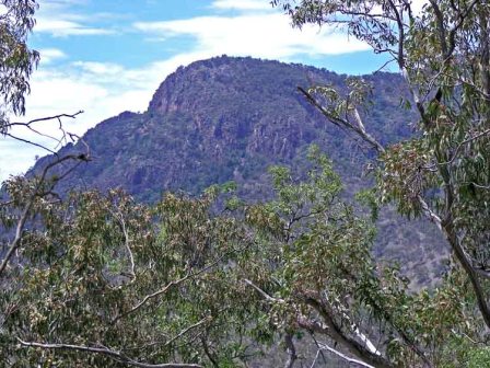
The Great Dividing Range dominates the area, dividing New England into a series of north-south zones.In the east, the humid coastal zone consists of a series of riverine valleys, with relatively short fast-flowing rivers separated from each other by spurs from the interior ranges.
Most of the valleys are small, except in the south where the zone broadens out into the Hunter Valley, and in the far north where the Clarence, Richmond and Tweed Rivers are less separated, and together form a broad unit known as the Northern Rivers.
Moving west, the humid coastal zone ends in a generally sharp escarpment, marking the start of a second geographic unit, the Northern or New England Tablelands. Although parts of the Tablelands rise to more than 1,500 metres, heights are generally about 900 metres, declining gradually to the west.
While clearly a geographical unit, the Tablelands display considerable geographical diversity.In the east the coastal river systems have cut huge gorges through the escarpment deep into the Tablelands. This combination of escarpment and gorges form the core of World Heritage listed national parks that run for hundreds of kilometres north-south (see http://www.nnsw.com.au/npa/nationalpark.html for more details). To the west of the escarpment and gorge country, the Tablelands are broken up into a series of tablelands of varying heights, separated to some degree by rougher country.
Further west, the Tablelands give way to the Western Slopes, a series of river basins separated by westward arms from the Tablelands, forming major headwaters for the Darling River system. In turn, the Slopes merge almost imperceptibly into the hot dry plains of the interior.
Related posts:
On Travel Time and Our Sense of Space is one of a series of posts that looks at the interaction between geography and perception. This post was followed by Geography of New England - Impact of Great Dividing Range; the escarpment and its impact on east-west communications and on life have influenced New England life thoughout human habitation. New England & Queensland - a truncated relationship points to the way in which human boundaries cut across geographical entities.
Much of New England live has been influenced by the rivers and river catchments. Aboriginal language groups were linked to rivers and river catchments. For that reason, I put up a number of posts with catchment maps. You can find the entry point to the series here.
To be continued.


4 comments:
I found your blog very interesting and full of important information. At present I am writing and publishing articles about Australia on my site. Frankly speaking I am looking for people who would like to cooperate with me - guide me a bit. Are you interested?
Happy to chat about this, gaba. What is your URL so that I can have a look?
It's www.anglisci.pl I have already published three articles about Australia and many other things. I am curious about your opinion.
Hi Gaba. Having looked at your site, this is best dealt with by email. Could you email me please on ndarala(at)optusnet.com.au
Post a Comment